

.svg)

Highlights
THE BOTTOM LINE
GPRS’ complete above and below-ground site visualization helped the electrical contractor plan tie-ins, avoid conflicts, and finish on schedule.
Industry
Power
Service
Utility Locating & Mapping, Concrete Scanning, Reality Capture
Location
GPRS Project Manager Insight
Deliverables
Site Markings, Job Services Report, SiteMap® Personal Access, Point Cloud File, TruView Virtual Tour, Integrated Structural & Subsurface BIM Model, 2D CAD Drawings
PROJECT APPLICATION
ASK
Task
Complete subsurface scans and 2-4 mm-accurate structural measurements for an integrated 360° visualization of an electrical substation to support infrastructure updates and upgrades
PROBLEM
- An electrical contractor was making substation upgrades that required the replacement and relocation of utility poles
- They needed to coordinate work along the main access road leading into the substation due to dense right-of-way (ROW) utilities
- 3D as-builts of existing site conditions were required to complete infrastructure updates and upgrades, capturing pole locations, overhead lines, and surrounding infrastructure
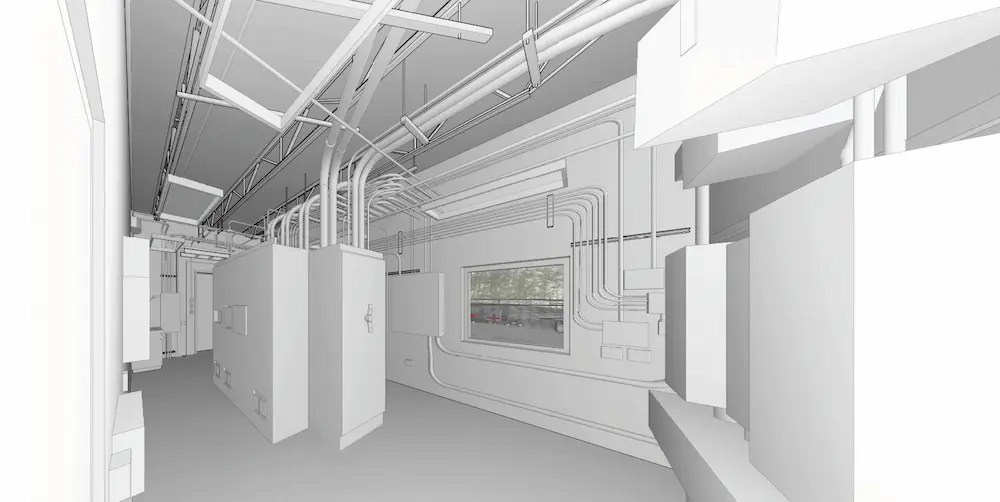
- No existing plans showed the location of conduit, rebar, or PT cables inside the mechanical and storage rooms at an onsite office where they planned to perform tie-ins
Solution
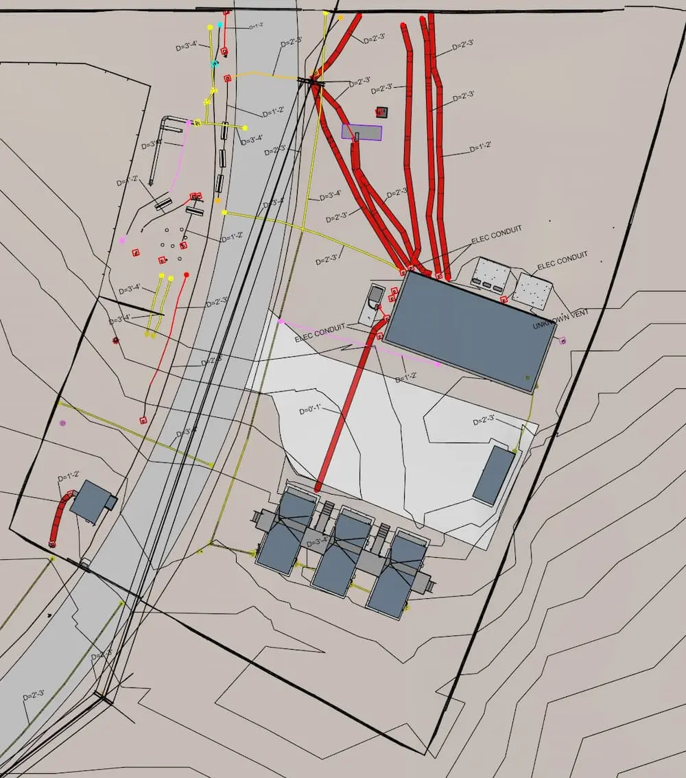
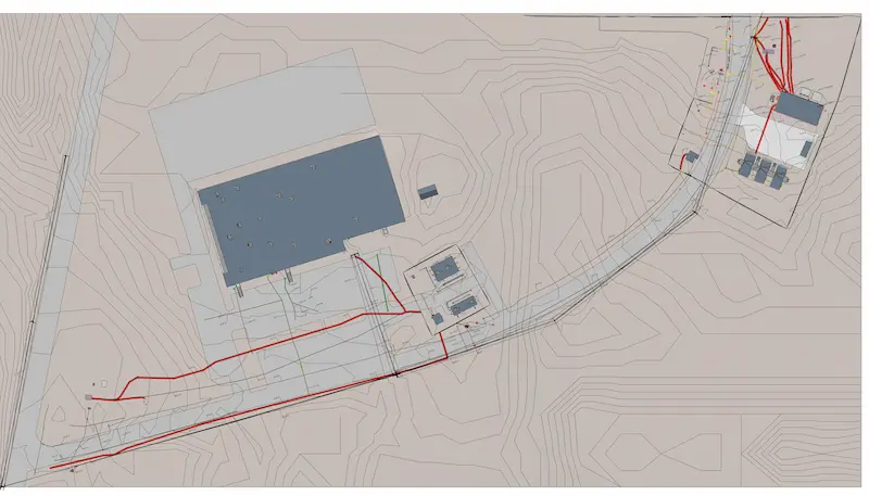
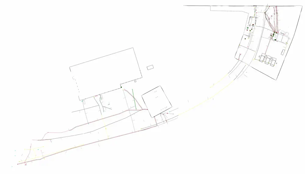
- GPRS Project Managers used ground penetrating radar (GPR) and electromagnetic (EM) locating to map 127,000 s.f. across the parking lot, the roadway to the main highway, and the main yard outside the building
- The PMs utilized GPR for concrete scanning in two office building rooms to visualize what was inside and under the concrete slab-on-grade
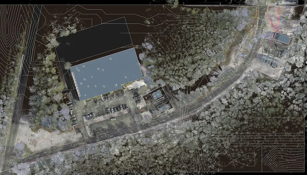
- Two LiDAR-based 3D laser scanners were used to scan 127,000 s.f. of bare earth, structural features, aerial infrastructure, and the existing powerlines, with color capture used to document utility markings
- Interior color 3D laser scans of the office building captured the concrete markings
Benefits
- The electrical contractor prevented costly overruns, saved time, and kept their workers safe while avoiding the risk of subsurface damage during construction
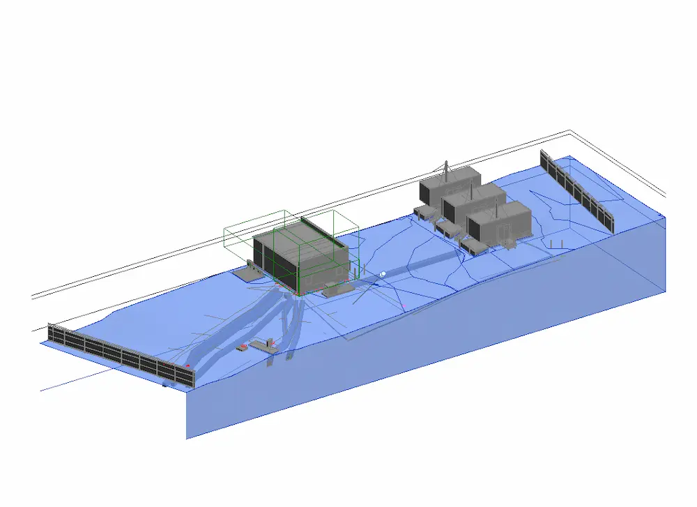
- The contractor received scan data, a TruView Virtual Tour, and an integrated structural and subsurface BIM model to support safe excavation and planning for the substation upgrades
- The project team could visualize the subsurface findings and collaborate seamlessly from any location via SiteMap®, GPRS’ GIS-based infrastructure platform and mobile application
CASE STUDY GALLERY
No items found.


.webp)


.avif)

