

.svg)

Highlights
THE BOTTOM LINE
By combining utility locating, video pipe inspection, and 3D laser scanning services, GPRS delivered comprehensive existing site conditions in an integrated BIM model for Clover Elementary School. The resulting maps, models, and reports, delivered in SiteMap, equipped Gilbane Building Company with the accurate data needed to execute design and construction with confidence.
Industry
Education
Service
Utility Locating, Video Pipe Inspection, 3D Laser Scanning, Mapping & Modeling, SiteMap
Location
Los Angeles, California
GPRS Project Manager Insight
Deliverables
Utility markings, GPS-enabled utility maps (KMZ and PDF), NASSCO-certified reports, point cloud in AutoDesk Recap (.RCP format), 3D subsurface utility BIM model (.DWG), integrated Navisworks model (.NWD), SiteMap® Project access
PROJECT APPLICATION
Subsurface Utility Locating, Video Pipe Inspection, and 3D Laser Scanning for a School
ASK
Task
Perform utility locating, video pipe inspection, and reality capture for a 7.7-acre site at Clover Elementary School in Los Angeles, CA. The GC, Gilbane Building Company, required an integrated BIM model of subsurface utilities and structural features, along with NASSCO-certified condition assessments of sewer and stormwater systems to support upcoming construction and renovation.
PROBLEM
The project scope included K–12 education design and preconstruction services, along with site improvements, demolition, utility upgrades, paving, and construction of a new two-story, 19-classroom building, as well as accessibility upgrades, HVAC replacement, classroom conversions, exterior stair and bridge replacements, and water and sewer infrastructure improvements.
Gilbane was responsible for a site analysis, preliminary and final schematic design development, and preparation of construction documents to support all phases of planning, coordination, and execution.
The project was complex and required GPRS expertise and coordination:
- The project required strict compliance with LAUSD standards, including state education codes, environmental regulations, and local labor agreements
- Shallow utility depths (less than 2 feet) made subsurface detection more difficult and increased risk during excavation
- Congested site conditions required expert scanning for accurate data collection
- Uncertainty in subsurface utility locations created potential for conflicts, delays, and design risks
- Sewer and storm systems needed to be safely accessed and evaluated without disrupting the active site
- Coordinating multiple scopes of work across the active school environment added complexity to planning and execution
Solution
GPRS deployed a multi-service approach to fully document both above- and below-ground conditions across the site, including:
- Private utility locating across 7.7 acres
- Video pipe inspection (VPI) of sewer and stormwater systems
- Reality capture via 3D laser scanning of the site
- Development of a 3D subsurface utility BIM model (approximately 16,500 linear feet of underground utilities were located and modeled as part of the project)
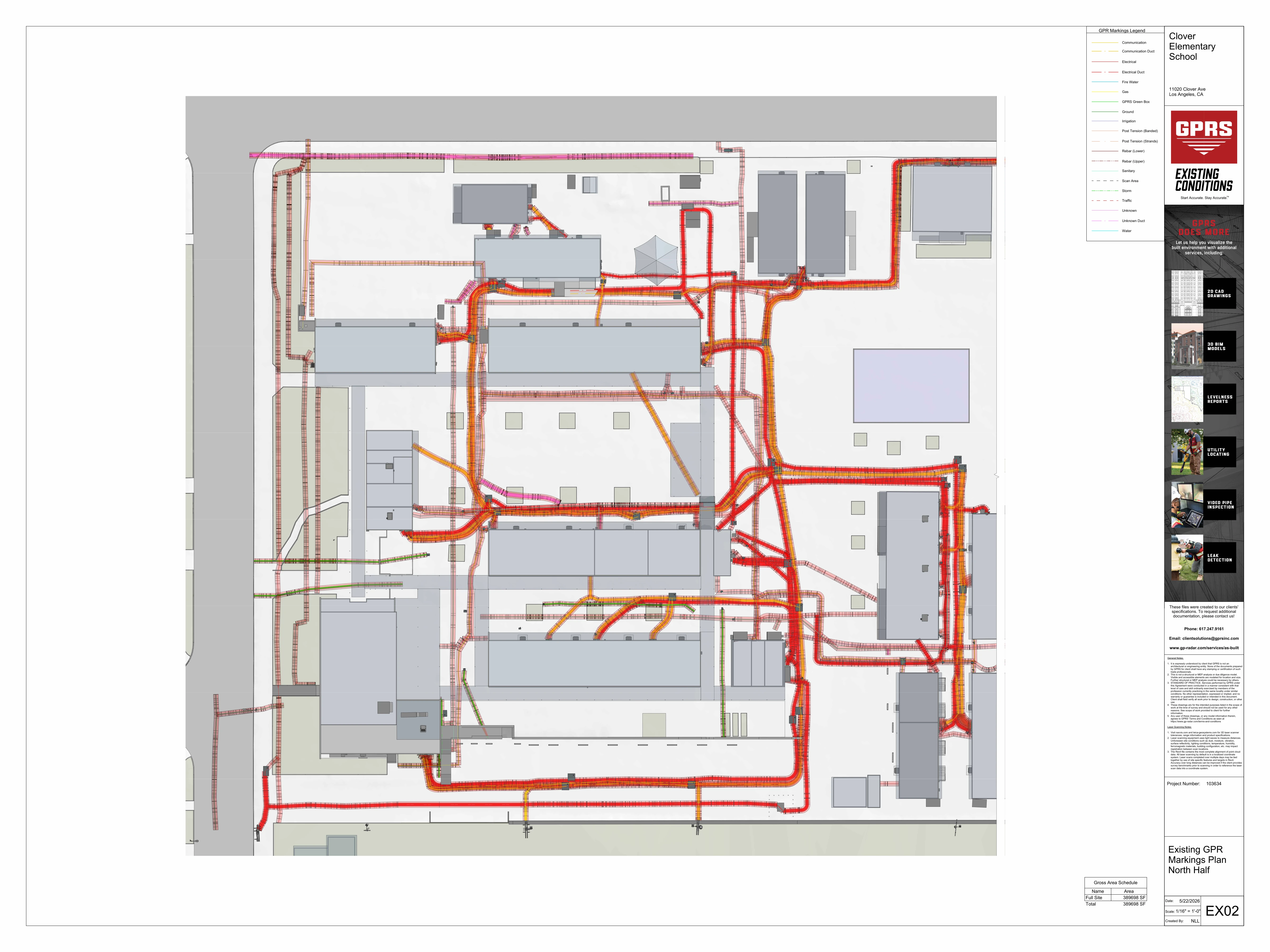
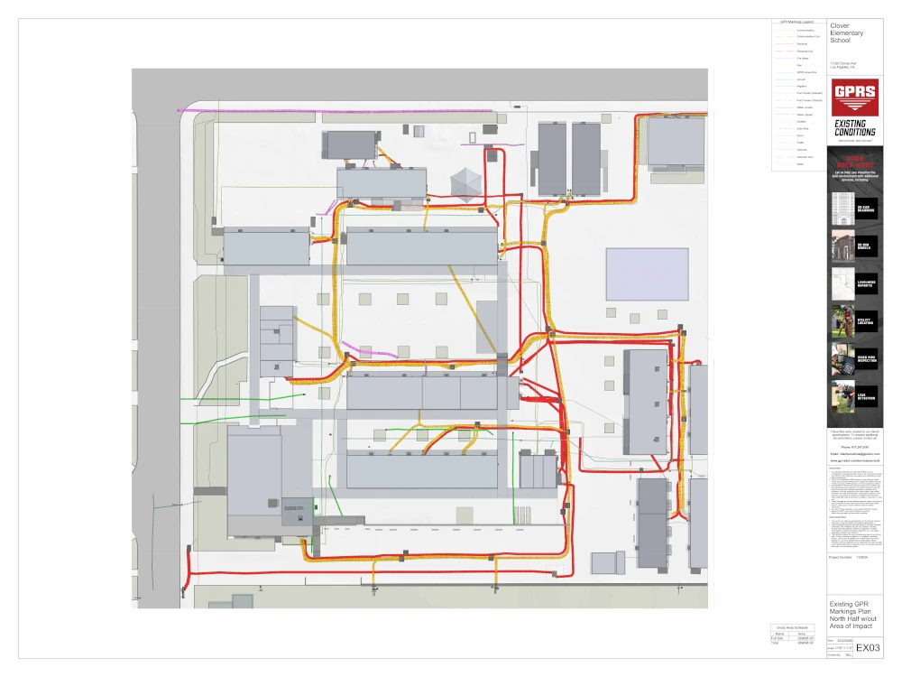
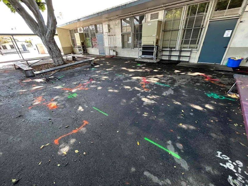
Utility Locating
GPRS utilized ground penetrating radar (GPR) and electromagnetic (EM) locating tools to identify underground utilities, including electrical, communication, gas, and water lines. All findings were marked on the surface with paint and reviewed with the client to ensure clear communication of results. Approximate depths to the top of findings were provided where applicable. Maximum GPR depth at this site was limited to less than 2’.
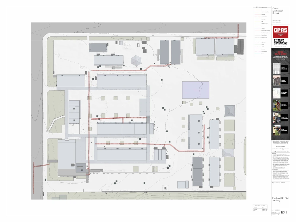
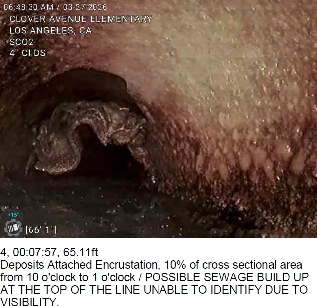
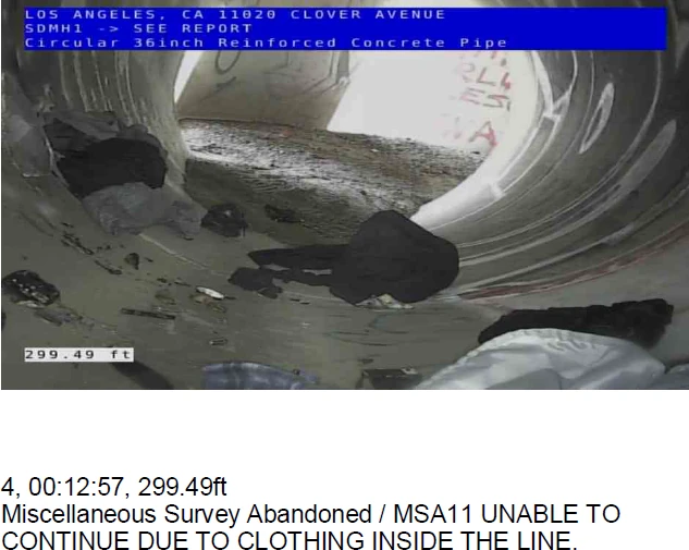
Video Pipe Inspection (VPI)
Robotic mainline crawlers, lateral launch cameras, and push cameras were deployed to inspect and record all accessible sanitary and storm lines. Each pipe segment was assessed and coded to NASSCO PACP, LACP, and MACP standards, documenting structural defects, blockages, and overall condition.
- Linear Footage Completed: Approximately 1,815 LF
- Pipe Segments Inspected: 26
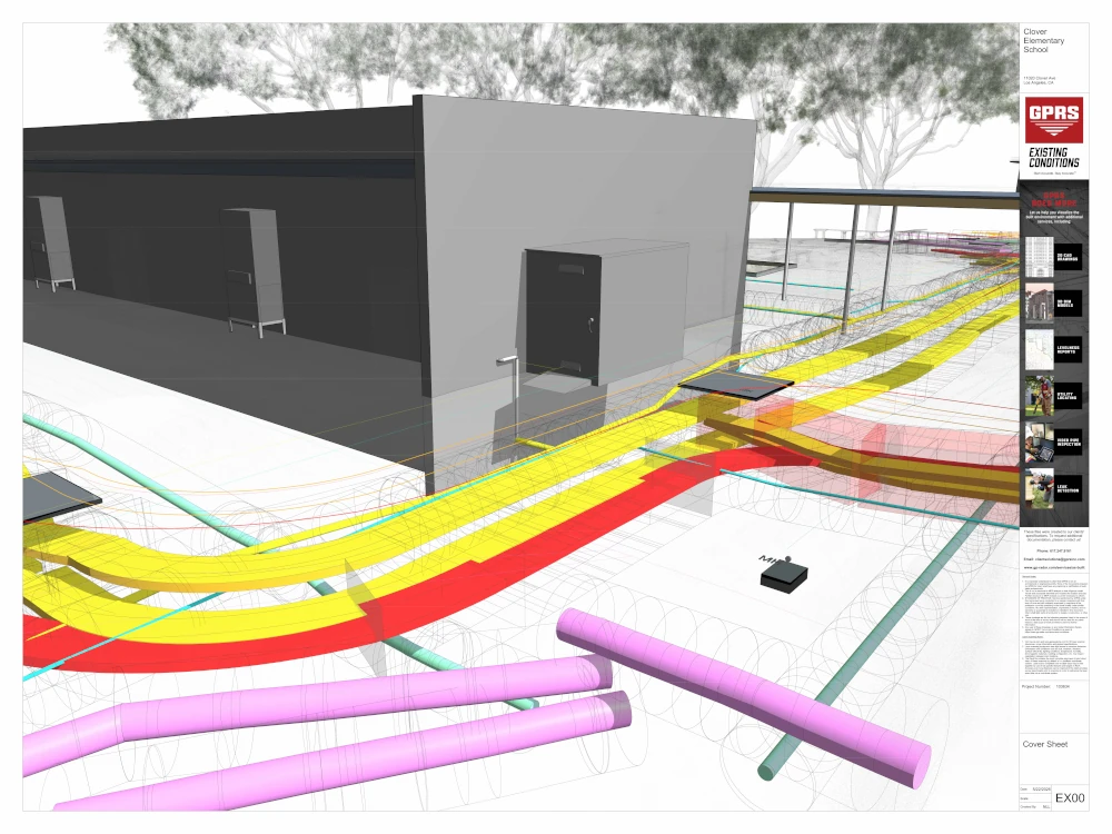
3D Laser Scanning & BIM Modeling
The site was captured using LiDAR scanning to generate a highly accurate point cloud. This data was used to create a 3D BIM model that included:
- Hardscape features (roads, curbs, sidewalks)
- Buildings depicted with basic massing models
- Above-ground surface elements connected to underground utilities (light poles, electrical boxes, fire hydrants, storm drains, manhole covers, communication boxes and poles, and other utility specific features)
- Underground utilities modeled using an assumed “average” diameter
- “Area of Impact” buffers for all utility lines modeled
Deliverables
GPRS provided a complete deliverables package to support planning, design, and construction:
- Utility markings and job summary report
- NASSCO-certified inspection reports with defect coding
- CCTV inspection videos (WinCan format)
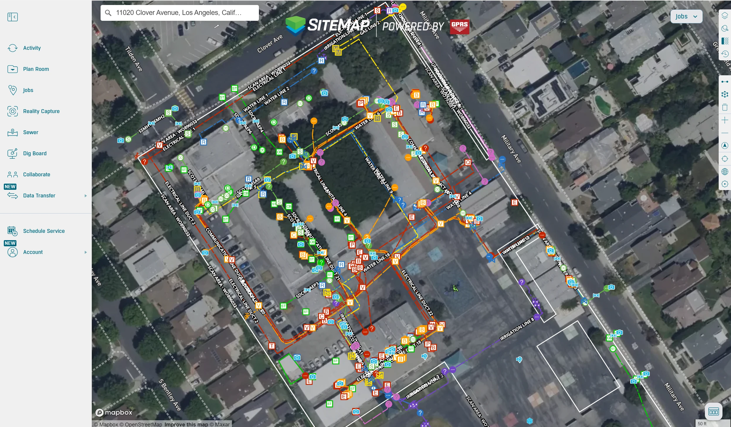
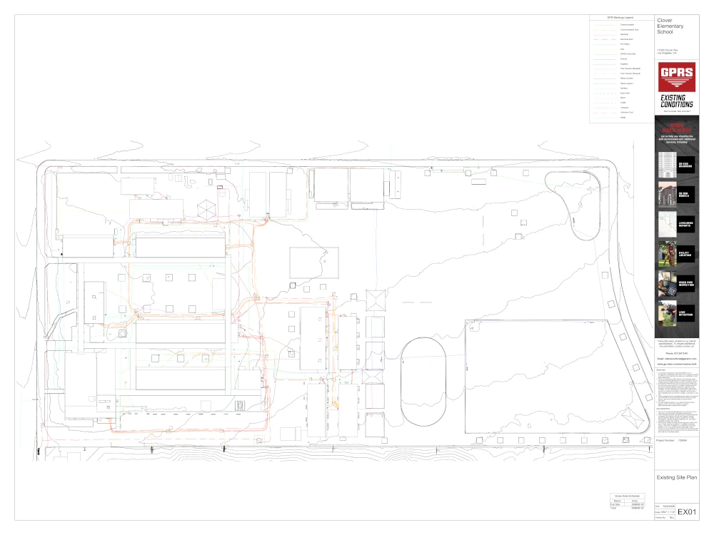
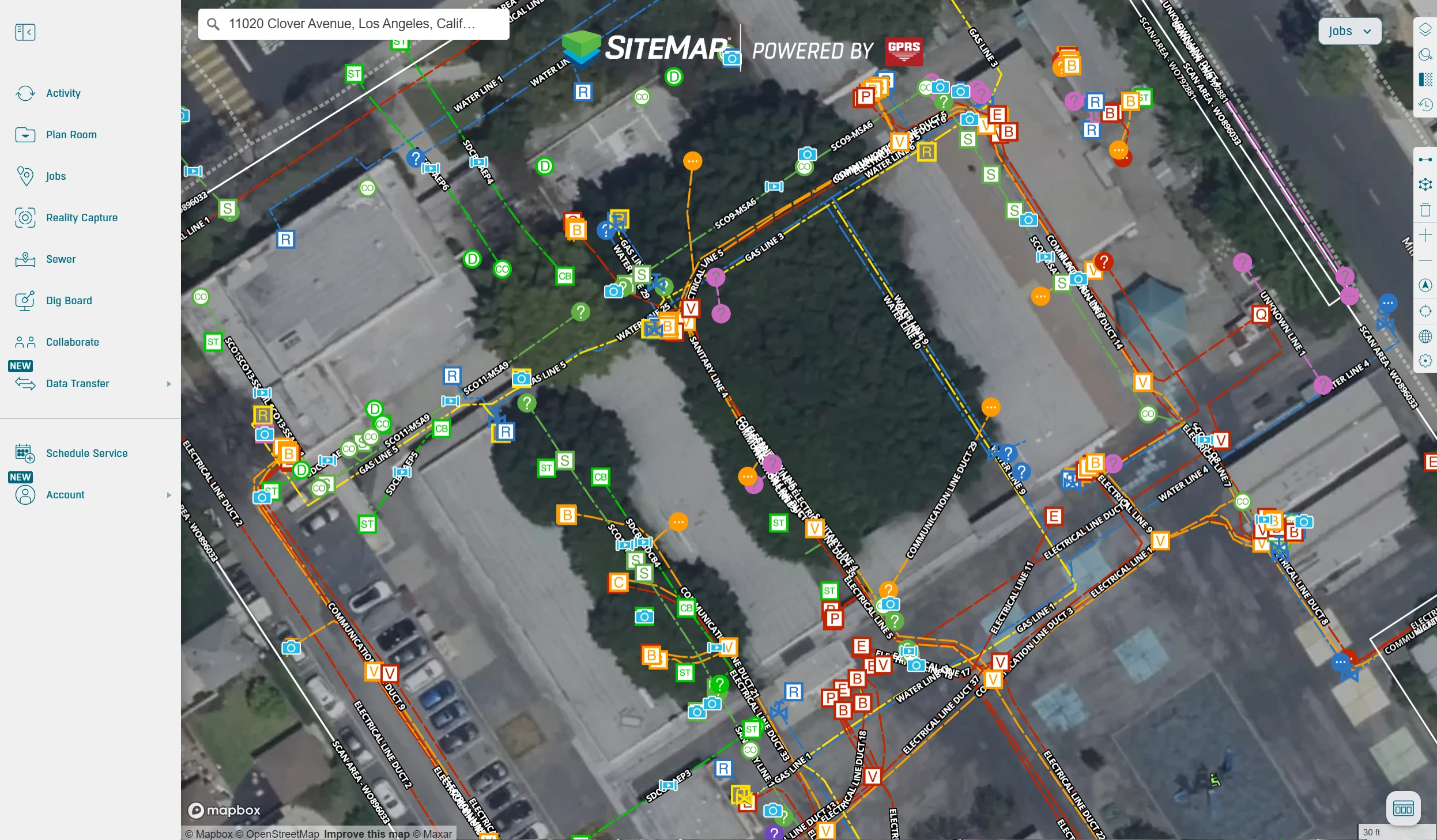
- GPS-enabled utility maps (KMZ + PDF)
- Point cloud in AutoDesk Recap (.RCP format)
- 3D subsurface utility BIM model (.RVT and .DWG)
- Integrated Navisworks model (.NWD)
- SiteMap® Project access for centralized data management and sharing
Benefits
- Detailed on-site utility markings provided clear visibility into underground infrastructure conditions
- A subsurface utility BIM model delivered a precise digital representation of underground systems
- Field-verified data reduced the risk of utility strikes and design conflicts
- Video pipe inspection identified internal blockages, accumulated debris, foreign objects (including clothing), and root intrusion within the pipeline
- Comprehensive site data enabled confident planning for excavation and construction
- Centralized deliverables in SiteMap improved coordination across project stakeholders
CASE STUDY GALLERY


.avif)
