

.svg)
Damage to critical buried infrastructure recently caused a scary situation at Jacksonville International Airport (JAX) in Jacksonville, Florida.
On June 20, air traffic controllers briefly lost radar capabilities after contractors cut a buried fiber optic cable during construction work.
According to The Associated Press, controllers were able to continue directing planes across five states in the Southeast because a backup system kicked in as designed. The Federal Aviation Administration (FAA) said no flights were disrupted.
“The FAA said the radar center in Jacksonville, Florida, continued operating but on alert status because its primary communication line went down,” the AP wrote. “A contractor was working on repairing the severed fiber line Friday afternoon. Authorities didn’t specify what caused the severed line or where it happened.”
While this event was, thankfully, resolved without incident, it serves as a reminder of how easily a single mistake when digging or trenching can put lives in danger.
Whether you’re digging just a few inches into the ground or several feet, or conducting your excavation utilizing directional drilling or other trenchless technologies, obtaining accurate utility locating and mapping data prior to breaking ground is the best way to avoid costly and potentially dangerous damage to buried infrastructure.
Why Are Fiber Optic Lines Especially Vulnerable?
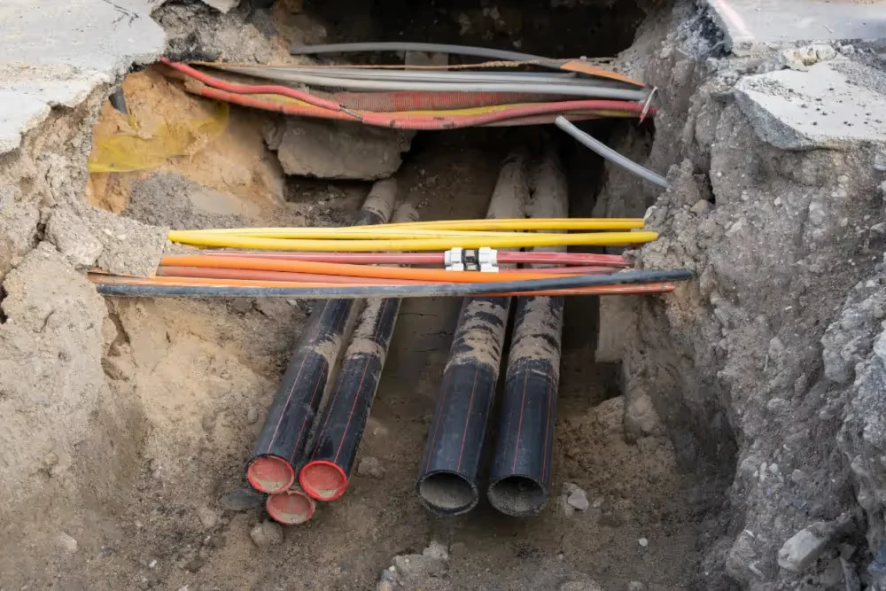
Unlike metal pipes or electrical lines, fiber optic cables are made of glass or plastic and do not emit electromagnetic signals. This makes them harder to detect using traditional methods. They are often installed with tracer wires within the conduit, allowing for the use of electromagnetic signal tracing. Utility locating companies use electromagnetic (EM) locators to detect these tracer wires.
The Cost of Damaging a Fiber Optic Line
At JAX, the severed fiber optic line likely served as a vital data link for radar systems. The consequences of such damage extend far beyond repair costs. In air traffic control, even a brief radar outage can delay hundreds of flights and jeopardize passenger safety. The FAA and other agencies must then reroute traffic and investigate the incident, pulling resources from other essential operations.
Hiring a professional utility locating company to find and map underground fiber optic cables and all other buried utilities prior to breaking ground is an essential step in mitigating the risk of costly and potentially dangerous subsurface damage.
How Do Utility Locating Services Help Prevent Subsurface Damage?
Utility locating services identify and map underground utilities before any digging or construction begins, helping to avoid accidental strikes that could cause costly damage, service outages, or safety hazards.
Calling your local 811 center should be your first step whenever you’re planning an excavation. Federal law requires you contact 811 to receive the approximate location of all registered utilities within your project area prior to breaking ground. Registered utilities can consist of both private and public lines, but it’s important to remember that not all utilities are registered with 811.
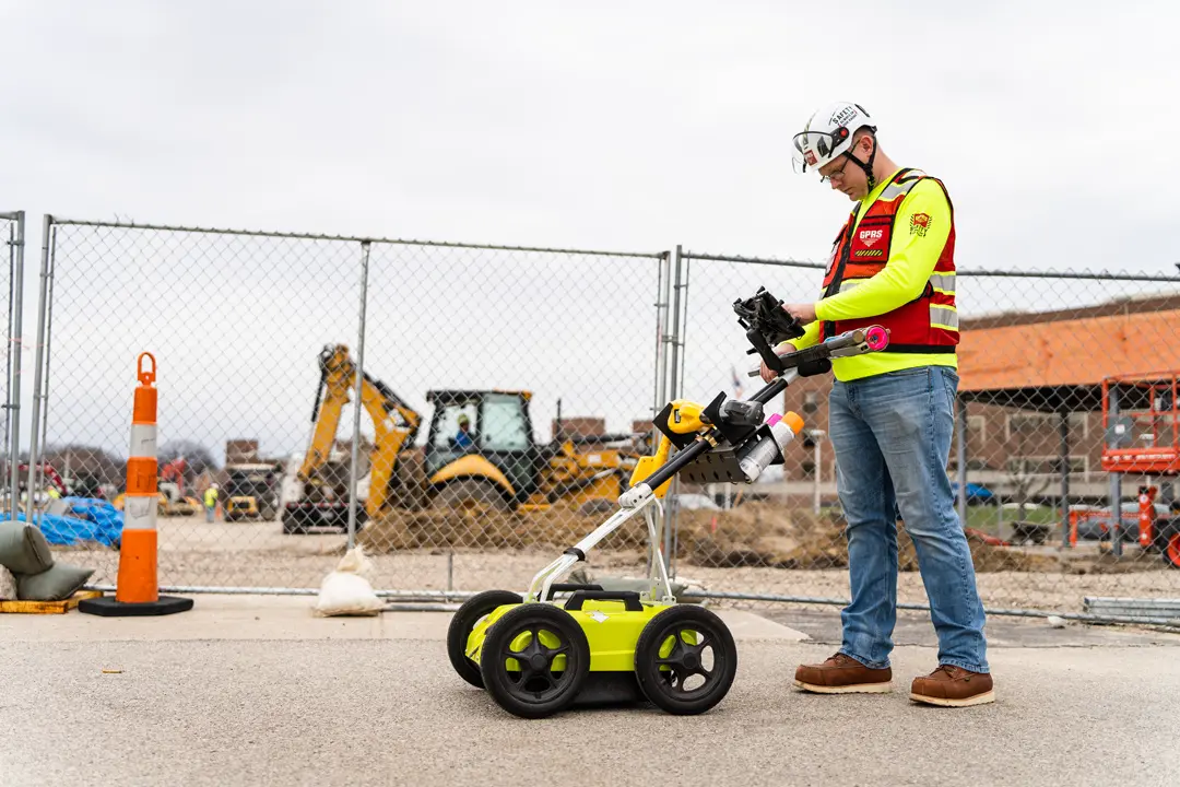
GPRS’ professional utility locating services complement the 811 locate by providing you with accurate and complete data about the buried infrastructure on your job site. GPRS uses a combination of tools, including ground penetrating radar (GPR), electromagnetic (EM) locators, and GPS mapping to detect both public and private utility lines.
Once utilities have been detected, they’re physically marked at the job site with highly visible, color-coded flags or paint to indicate their type and precise location. These markings serve as a visual guide for construction crews, helping them navigate around underground infrastructure safely and accurately during excavation and construction.
The GPRS Mapping & Modeling team provides digital maps and .KMZ files that can be integrated into construction planning software, ensuring that crews have real-time access to utility layouts.
SiteMap®, (patent pending), powered by GPRS, is our proprietary infrastructure mapping software solution that provides you and your team with 24/7, secure access to the accurate, field-verified data collected by GPRS Project Managers. Accessible from any computer, tablet or smartphone, it is a single source of truth for the critical infrastructure you and your team needs to plan, manage, and build better.
GPRS Intelligently Visualizes The Built World® to keep your projects on time, on budget, and safe.
What can we help you visualize?
Read Also: How is Utility Locating Done?