.svg)

.svg)

Southern California sits on one of the most seismically active landscapes in the United States. Los Angeles County alone contains more than 50 active and potentially active fault segments, with additional buried faults and blind thrust faults capable of producing damaging earthquakes at any time. The 1994 Northridge earthquake, a magnitude 6.7 event, caused an estimated $20 billion in damage and remains one of the costliest seismic events in U.S. history. The quake also reshaped how California responds to infrastructure emergencies. The Santa Monica Freeway, knocked out by Northridge, was rebuilt under emergency contracting protocols, and those same protocols guided the rapid reopening of the I-10 after it was damaged more recently.
The structural damage from seismic events is only part of the picture. The infrastructure buried beneath the surface (water mains, gas lines, sewer systems, stormwater drains, electrical conduit, and telecommunication lines) is equally vulnerable, and often more difficult to assess and repair. According to research from the Caltech Science Exchange, the 10 million residents of Los Angeles County depend on a complex network of water and gas pipelines, electrical and communication cables, and over 22,000 miles of public roads. Damage to any single component of that network can cascade through the rest.
Understanding how seismic events affect both buried and aboveground utility infrastructure, and what steps facility owners, municipalities, and construction teams can take before and after an earthquake, is critical to protecting public safety and minimizing costly service disruptions. It starts with knowing exactly what is in the ground before the shaking begins, which is where accurate utility locating and current as-built documentation come in.
How Earthquakes Damage Buried Utilities
Seismic events generate two types of ground deformation that directly affect underground infrastructure: temporary ground displacement caused by the passage of seismic waves, and permanent ground displacement caused by fault rupture, liquefaction (when saturated soil loses strength and behaves like a liquid) , or lateral spreading (when that weakened soil slides sideways across a slope or toward an open face).
Both types of movement place extreme stress on buried pipelines, conduit, and cable networks. The most common forms of damage include:
- Joint separation and offset. Pipe joints, particularly in older cast iron, clay, and asbestos cement systems, can pull apart, shift, or shear under ground movement. This is the most frequent failure mode in municipal water and sewer systems during seismic events.
- Pipe fracture and buckling. Rigid pipe materials are especially vulnerable to compressive forces caused by fault displacement. Ductile iron, welded steel, and high density polyethylene (HDPE) pipes perform better under seismic stress, though they remain susceptible to failure at connections, bends, and tees. These pipes face a separate vulnerability in freezing conditions, an issue of growing concern in places like Texas, where a rising frost line is increasingly implicated in water line failures.
- Liquefaction-induced settlement. In areas with loose, saturated soils, common in portions of the LA Basin, seismic shaking can cause the ground to behave like a liquid. Buried pipes can float, sink, or shift laterally, severing connections and disrupting grades.
- Cross-bore exposure. Ground movement can shift the position of existing utilities relative to one another, creating new intersections between gas, sewer, and water lines that did not exist prior to the event.
How Earthquakes Damage Aboveground Utilities and Structures
Aboveground utility infrastructure, including electrical transmission lines, transformers, substations, and aboveground piping, faces a different set of seismic risks:
- Structural damage to utility supports. Poles, towers, and equipment pads can shift, tilt, or collapse when foundations settle or liquefy. Utilities are increasingly burying critical lines to reduce their exposure to natural hazards.
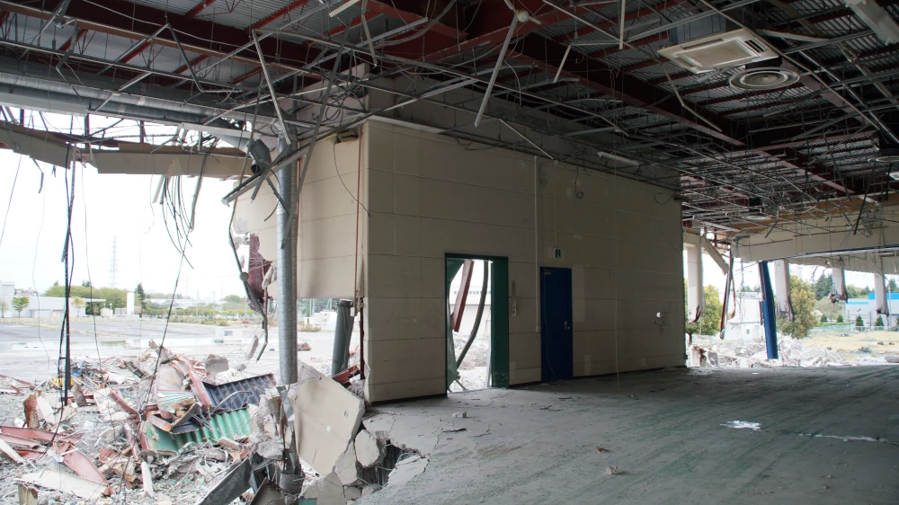
- Conduit and raceway damage in occupied buildings. Electrical and mechanical systems running through concrete slabs and structural walls can be compromised when the building itself shifts. Expansion joints, penetrations, and anchoring points are common failure locations.
- Loss of reference for existing infrastructure. After significant ground movement, the physical position of buried utilities may no longer match existing as-built records or GIS data. Surface markers, valve boxes, and manholes may have shifted, making previously documented utility locations unreliable.
This last point is one of the most underappreciated consequences of seismic events: even if a utility line survives the earthquake intact, the records used to locate it may no longer be accurate.
Why Accurate Utility Data Is the First Line of Defense
The recovery timeline after a major earthquake depends heavily on how quickly utility systems can be assessed, repaired, and restored. According to the Southern California Earthquake Country Alliance's ShakeOut Scenario, disruption of utilities is the primary factor that slows long-term business recovery, more than building damage or transportation disruption.
Municipalities, facility owners, and construction teams that maintain accurate, current as-built records of their underground and aboveground infrastructure are better positioned to respond. Specifically, accurate utility data helps to:
- Accelerate post-event damage assessment. When crews know where every pipe, conduit, and cable is located, and at what depth, they can prioritize inspections and avoid secondary damage during repair excavation.
- Identify pre-existing vulnerabilities. Older pipe materials, undocumented utility crossings, and areas with known liquefaction potential can be flagged in advance and addressed before an event occurs.
- Prevent utility strikes during reconstruction. Post-earthquake construction and repair work often takes place under emergency conditions, with compressed timelines and reduced margin for error. Accurate utility maps reduce the risk of hitting a gas line or live conduit during excavation.
- Establish a baseline for insurance and compliance documentation. Pre-event as-built records provide a defensible reference point for damage claims and regulatory reporting.
How GPRS Helps Mitigate Seismic Risk to Utilities
GPRS provides the subsurface and aboveground infrastructure data that facility owners, municipalities, and construction teams need to prepare for, and recover from, seismic events.
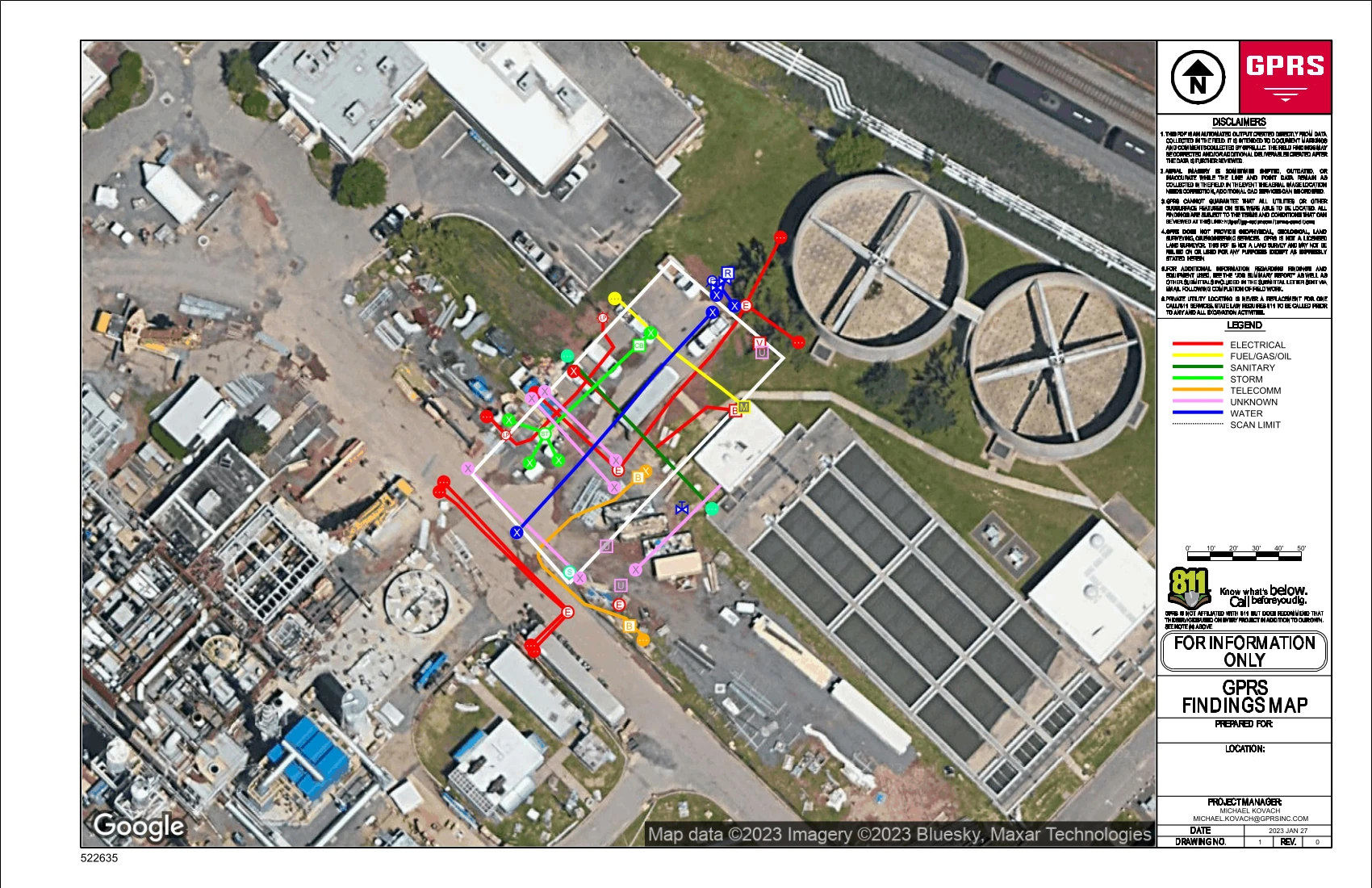
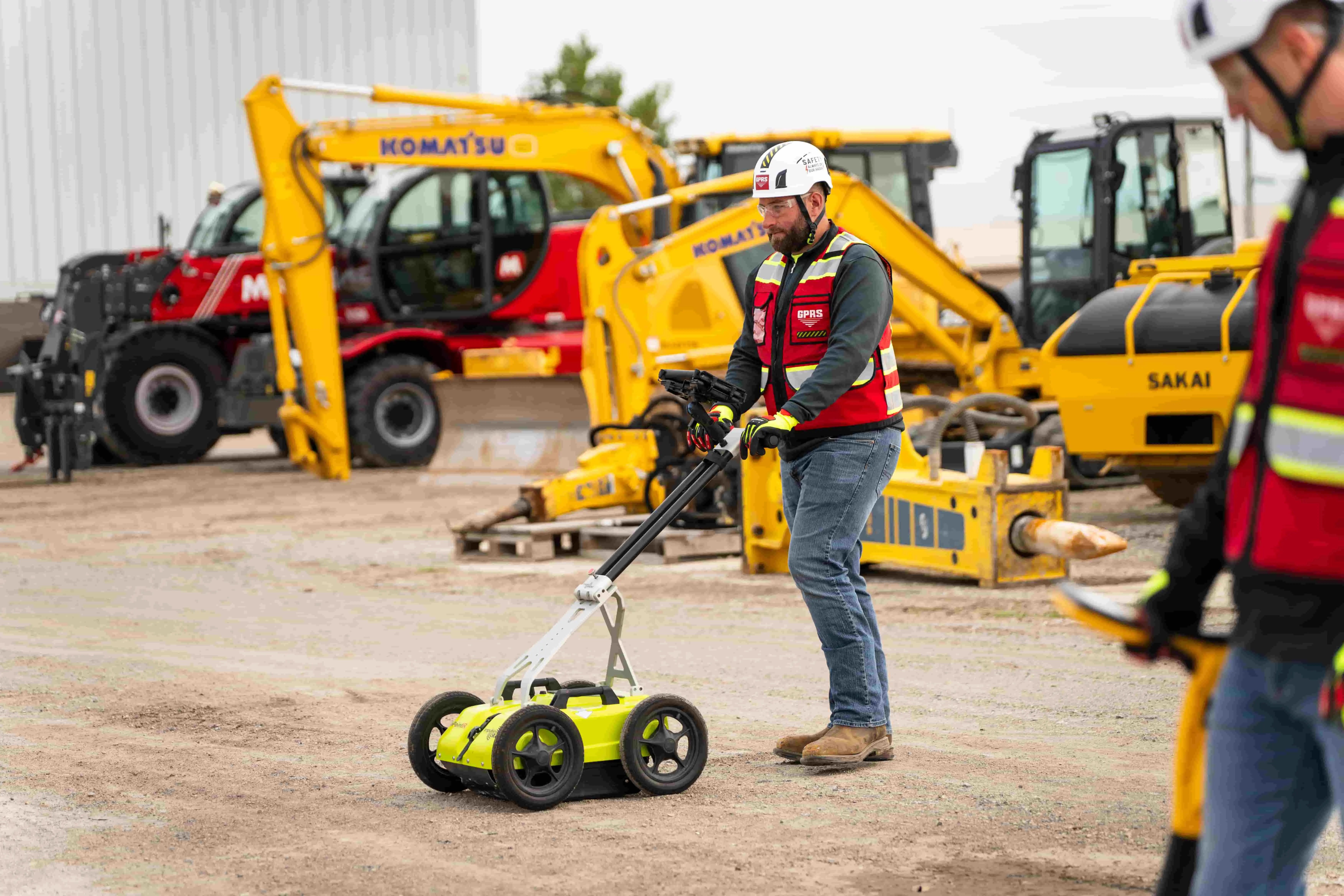
Pre-event utility mapping and as-built creation. GPRS SIM-certified Project Managers use ground penetrating radar (GPR) and electromagnetic (EM) locating to map every buried utility on a site, including private lines that 811 does not locate. That data is delivered via SiteMap®, GPRS' cloud-based platform, where it is accessible 24/7 from any device and can be shared securely with engineers, contractors, and emergency response teams.
Post-event damage assessment. After a seismic event, GPRS can mobilize Project Managers to re-survey affected areas, identify shifts in utility position, and update existing records. Leak detection services can pinpoint water main and service line breaks without excavation, and video pipe inspection performed by NASSCO PACP-certified technicians can assess the interior condition of sewer and stormwater systems to document cracks, offsets, and structural failures.
3D laser scanning for structural documentation. For aboveground infrastructure and occupied buildings, GPRS 3D laser scanning captures millimeter-accurate as-built data of architectural, structural, and MEP systems. This baseline documentation is critical for planning seismic retrofits and for comparing pre- and post-event conditions.
GPRS operates in all 50 states, with Project Managers stationed in every major California market, including Los Angeles, San Diego, Sacramento, and the San Francisco Bay Area.
Frequently Asked Questions
How do earthquakes damage underground utility lines?
Earthquakes damage underground utilities through ground displacement, liquefaction, and lateral spreading. These forces cause pipe joints to separate, rigid pipes to fracture, and utility lines to shift from their documented positions. Older pipe materials (cast iron, clay, and asbestos cement) are the most vulnerable, and during the 1994 Northridge quake ruptured water mains flooded city streets. Because much of this damage is invisible from the surface, documenting it requires GPR, EM locating, or CCTV pipe inspection, delivered by GPRS as field-verified utility maps with a documented 99.8% accuracy rate.
Why is utility mapping important before an earthquake?
Accurate utility maps provide a baseline record of where every pipe, conduit, and cable is located and at what depth. After a seismic event, that baseline allows crews to identify what has shifted, prioritize inspections, and avoid hitting undocumented or displaced utilities during emergency excavation. Without current as-built records, recovery teams are working blind, which increases the risk of secondary damage, delays, and safety incidents. GPRS captures that baseline through utility locating and stores it in SiteMap® for 24/7 access by engineers, contractors, and response teams.
What should facility owners in California do to prepare their underground infrastructure for earthquakes?
Facility owners should start with a comprehensive utility survey to document all buried infrastructure, including private lines not covered by 811. That data should be stored in an accessible, shareable format such as a GIS platform. For buildings and aboveground systems, 3D laser scanning creates a high-density as-built record of existing conditions that can be used for seismic retrofit planning and post-event comparison. GPRS provides both services, with all data delivered and stored via SiteMap® for 24/7 access.
Can GPRS assess utility damage after an earthquake?
Yes. GPRS can mobilize Project Managers to re-survey affected sites, update utility maps, and identify infrastructure that has shifted. Leak detection services locate water and service line breaks without excavation, and pipe inspection by NASSCO PACP-certified technicians documents the interior condition of sewer and stormwater systems. 3D laser scanning can capture post-event conditions of buildings and structures for comparison against pre-event documentation.
GPRS can help you intelligently visualize your subsurface and aboveground infrastructure, before and after a seismic event, to keep your projects on time, on budget, and safe.