

.svg)

Accurately mapping underground utilities in active roadway corridors, rights-of-way, and dense urban environments remains one of the most challenging aspects of civil and infrastructure projects. Traditional utility locating methods, while effective for isolated projects, are labor-intensive, require specialized traffic management, cause traffic disruptions, and often fall short in providing the comprehensive data necessary for large-scale roadway and infrastructure development.
Recent advancements in high-speed 3D Ground Penetrating Radar (GPR) technology are changing that reality. High-speed GPR arrays now enable subsurface utility investigations to be conducted at highway speeds without the need for lane closures, delivering high-resolution 3D imaging at previously unheard of levels of efficiency and accuracy. One such system, the Raptor® High-Speed 3D GPR Array by ImpulseRadar, is currently being deployed by GPRS to revolutionize the collection of subsurface utility data.
Challenges of Subsurface Utility Mapping in Transportation Infrastructure
The subsurface environment beneath roadways and rights-of-way is inherently complex. Utilities often overlap, cross, and diverge at varying depths, and older, abandoned, and undocumented prior installations can complicate planning efforts. Failure to properly identify and map these utilities can result in utility strikes, project delays, increased costs, and safety hazards. According to the Common Ground Alliance, utility strikes cost the U.S. economy approximately $30 billion annually. Other figures put that number well over $61 billion.
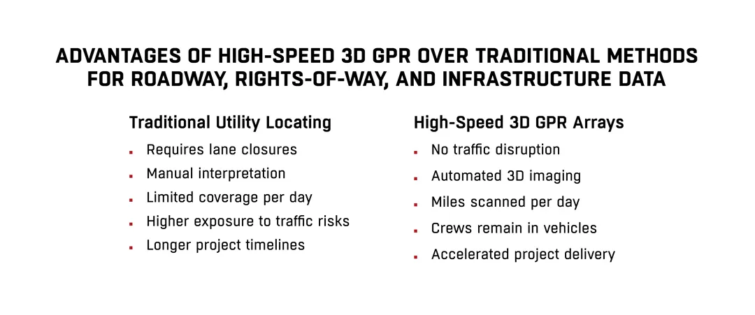
Traditional methods – such as electromagnetic locating and traditional pushcart GPR scanning – require lane closures, manual scanning, and detailed manual interpretation of collected data, increasing time, cost, and risk. For large projects covering many miles of roadway, the traditional approach poses a host of logistical challenges.
Introduction to High-Speed 3D GPR Arrays
High-speed 3D GPR arrays address these challenges by collecting dense, accurate subsurface data at speeds of up to 80mph, reducing the need for traffic interruptions or additional traffic control measures while increasing safety and efficiency.
The Raptor 3D GPR array, for example, utilizes 18 synchronized antenna channels capable of capturing continuous 3D images of subsurface conditions at speeds up to 80 mph (130 km/h) with a 5 cm trace interval. This technology allows for comprehensive mapping in real time while maintaining traffic flow.
Key technical specifications include:
• Speed: Up to 80 mph (130 km/h) without data degradation
• Trace Interval: 5 centimeters
• Data Channels: 18 GPR antennas (450 MHz or 800 MHz configuration)
• Positioning: Real-Time Kinematic (RTK,) GPS, or Robotic Total Station (RTS)
• Software: Real-time visualization and post-processing with Condor® 3D and Osprey® for detailed tomography

How High-Speed 3D GPR Arrays Improve Accuracy
Accuracy in subsurface utility mapping depends on both the quality of the signal data and the precision of its geolocation. High-speed 3D GPR arrays excel in both areas.
1. Dense Sampling: The 5 cm trace interval allows for extremely dense data collection, minimizing the gaps and interpolation errors common in lower-resolution surveys.
2. Positioning Precision: By utilizing RTS and RTK GPS, high-speed GPR arrays achieve centimeter-level positioning accuracy, significantly surpassing standard GPS methodologies which have positional errors up to several meters
3. Real-Time Quality Control: Onboard visualization capabilities allow operators to assess data quality immediately, enabling rescans if necessary while still on site.
4. Advanced Data Processing: Post-processing with software such as Condor 3D and Osprey provides detailed 3D volumetric imaging of subsurface features, allowing civil engineers to model underground environments with confidence.
And for GPRS, field validation utilizing the Subsurface Investigation Methodology (SIM) framework has resulted in a reported utility locating accuracy rate of 99.8% when using high-speed arrays combined with professional verification.
Primary Applications for High-Speed 3D GPR Arrays
High-speed 3D GPR arrays are transforming numerous sectors within the civil and infrastructure fields:
Roadway and Right-of-Way Utility Mapping
Civil engineers, surveyors, and utility managers tasked with roadway expansions, resurfacing, and maintenance require accurate mapping of buried infrastructure. High-speed GPR arrays deliver full-corridor scans quickly and without disrupting traffic.
Bridge and Pavement Condition Assessment
GPR arrays can be utilized to assess pavement thickness, layer interfaces, and even moisture intrusion. These insights can inform maintenance planning and extend asset life.
Rights-of-Way (ROW) Engineering
ROW engineers benefit from full-coverage subsurface mapping that can identify utility encroachments, validate clearances, and support legal documentation for infrastructure development.
Environmental and Geotechnical Investigations
3D GPR data supports Phase I and Phase II Environmental Site Assessments (ESAs) by identifying potential underground storage tanks (USTs), and preferential contaminant pathways without intrusive digging.
Urban Infrastructure Development
For projects in congested urban environments, where overlapping utilities and complex subsurface conditions prevail, high-speed arrays offer a non-disruptive, comprehensive method to model subsurface utilities prior to construction.
Other Specialized Applications
• Mining: Mapping tunnels and mineral seams
• Archaeology: Non-invasive surveys for buried structures
• Defense: Detection of unexploded ordnance (UXO) and subsurface threats
Technology Deployment: GPRS and the Raptor® High-Speed 3D GPR
GPRS’ deployment of high speed GPR arrays represents a significant step forward in roadway and utility locating services.
Notable capabilities include:
• Zero Lane Closures Required: Survey vehicles operate at normal traffic speeds
• Nationwide Mobilization: SIM-certified Project Managers in every major U.S. market
• Data Deliverables: CAD files, PDFs, GIS-ready exports (KML, KMZ, shapefiles), and full access via SiteMap® cloud portal are available depending on your needs
SiteMap® (patent pending) provides 24/7 access to survey data through an interactive, layered map view, improving collaboration between project stakeholders.
The safety and efficiency benefits alone justify consideration of high-speed GPR arrays for large or critical projects.
Technical Limitations
While high-speed GPR arrays offer significant advantages, they are not without limitations:
• Soil Conductivity: High conductivity soils (e.g., clays, wet environments) can impact GPR signals.
• Obstructions: Metallic objects, reinforced concrete, and subsurface debris may cause data clutter.
• Depth Penetration: Higher frequency antennas (e.g., 800 MHz) provide greater resolution but shallower penetration, whereas lower frequency (e.g., 450 MHz) antennas penetrate deeper with reduced resolution.
We recently found abandoned tunnels at 11 ft. under a roadway using the high-speed array. You can learn more here.
What does a High-Speed 3D GPR Array Cost to Operate?
With the many benefits of high-speed 3D GPR scanning, you might wonder if it is cost-effective for a utility, municipality, or facilities manager to purchase one for their use.
The cost to purchase a high-speed 3D GPR array is approximately $160,000 per unit and does not include additional tools like tablets, or processing hardware/software.
You can rent a high-speed unit for about $1,500 per day with a $750 set up fee. However, the level of accuracy you will achieve rests on the abilities of highly trained specialists in ground penetrating radar, CAD design, data registration, and modeling to interpret the GPR findings and turn them into useable maps and models for project use.
Understanding these factors is critical for selecting the correct survey parameters and interpreting results.
GPRS provides tailored RFPs, RFQs, and quotes for customers throughout the U.S. To learn more about our pricing for high-speed GPR array services, click below.
Future Outlook
The adoption of high-speed 3D GPR is poised to increase dramatically. As more municipal agencies, departments of transportation, and private developers recognize the cost savings, risk mitigation, and safety improvements it offers, high-speed GPR arrays will likely become a new standard for large-scale infrastructure projects.
Emerging developments in antenna design, real-time data analytics, and AI-assisted interpretation promise to make high-speed GPR even more effective in the near future.
High-speed 3D GPR arrays represent a transformative advance in subsurface utility mapping, roadway condition assessment, and infrastructure project management. With the ability to safely, rapidly, and accurately collect vast amounts of subsurface data, they deliver tangible benefits for civil engineers, municipal managers, utility owners, and general contractors tasked with maintaining and expanding critical infrastructure.
By combining state-of-the-art hardware with rigorous methodology and professional expertise, GPRS is setting new standards for accuracy, safety, and efficiency in subsurface investigations.
For engineers and project managers facing the demands of complex roadway and right-of-way projects, high-speed 3D GPR arrays are not just an innovation—they are rapidly becoming an essential tool for success when it comes to Intelligently Visualizing The Built World®.
What can we help you visualize?