

.svg)
GPRS utilized leak detection and utility locating equipment to help uncover the hidden source of a hazardous leak at an elementary school in California.
Thornhill Elementary School in Oakland, California has been in operation since 1958 and currently services approximately 400 students.
To keep pickups and drop offs organized, they have a designated area for that near the school’s entrance, so students and parents know where to go at the beginning and end of the school day. Administrators had noticed water surfacing in that area.
While no student had slipped or fallen, school officials didn’t want the problem to persist until someone did.
And algae had begun to grow in it as well, so they needed to address the issue quickly.
The school tasked GPRS Leak Detection Project Manager William Walhovd with locating the source of the leak before any kids were harmed.
Walhovd arrived at the school thirty minutes before the students arrived. However, students began showing up before he could identify the leak.
Thanks to his previous working relationship with the client, Walhovd was able to continue the job without affecting the school day.
“I've done a lot of work with that school district in the past,” Walhovd explained. “We usually try to get there as early as we can, but those guys are pretty good. They show up and have things ready for me before I get there because we try to get in and get out really quick.”
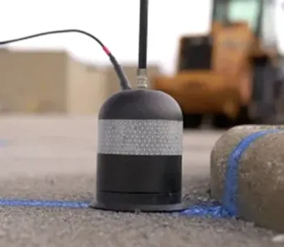
Walhovd began the leak detection process by listening for the leak with an acoustic leak detector.
“Usually when the water's surfacing, I try to listen to the surface where the water's coming out because usually, I can hear something,” Walhovd explained. “In this case, it was a pretty wide area and it wasn't making very much noise.”
Since our Leak Detection Project Managers are also expertly trained in utility locating, Walhovd shifted gears to ensure he could pinpoint the leak.
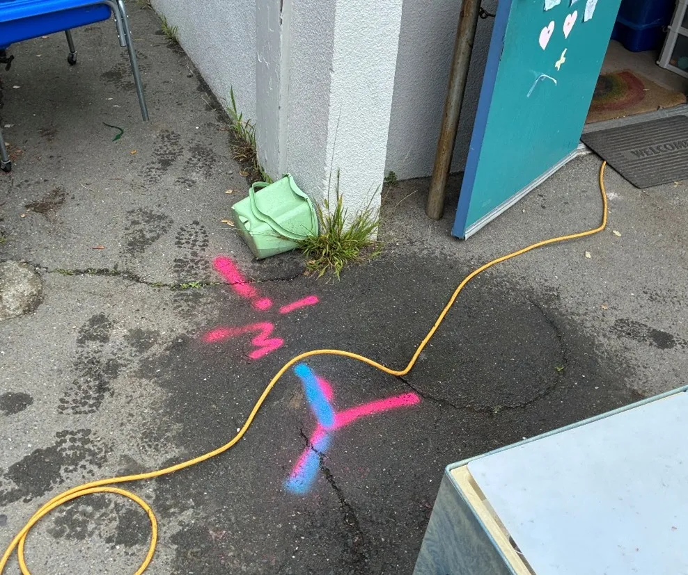
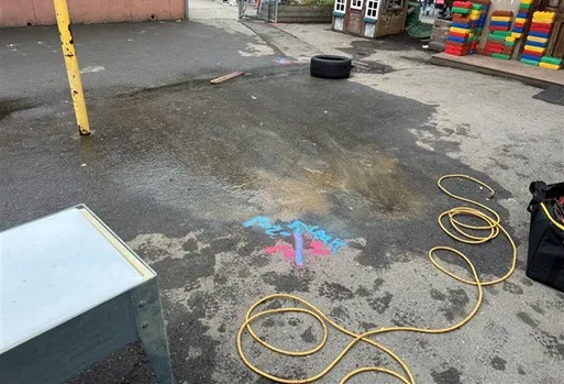
“Then, we switched over to locating the pipes that may potentially run through there,” Walhovd explained. “So, we connected to a bunch of different water lines until that one showed up. We marked the location of it. We knew exactly where it was running through, and we knew what lines it connected to.”
GPRS Project Managers utilize electromagnetic (EM) locators and ground penetrating radar (GPR) to locate utilities. The way these devices collect data is complementary to the other, allowing for the most accurate results.
New layers added over the years made the asphalt above the water lines very thick. Because of this, the signal was still faint.
However, Walhovd had one more trick up his sleeve to ensure he could listen to the pipes and locate the leak.
“Since we still couldn’t hear the pipes through the asphalt, we drilled some holes so that we could listen closer,” Walhovd explained. “I put a probe in the ground to allow the sound to reach my microphone better.”
Upon further investigation, Walhovd discovered a previously unknown buried water valve that controlled the leaking pipe.
Without GPRS’ 99.8% accurate utility scans and pinpoint leak detection services, that valve would have stayed lost and the leak would have continued, putting more students, teachers, and parents at risk.
Walhovd shared his findings with the client via SiteMap® (patent pending), GPRS’ cloud-based infrastructure management platform that shows your above and below ground infrastructure in one place.
From skyscrapers to sewer lines, GPRS Visualizes YOUR Built World® to keep your projects on time, on budget, and safe.
What can we help you visualize?
FREQUENTLY ASKED QUESTIONS
What is an annual leak survey and why do they matter?
An annual leak survey is a scheduled inspection of water infrastructure to identify and document leaks. These surveys are critical for regulatory compliance, environmental protection, and cost control. Regular assessments reduce water loss, prevent hazardous conditions, and extend asset life. For municipalities and facilities, annual surveys support proactive maintenance and budget forecasting.
How long does a leak detection usually take?
How long it takes to find your leak depends on the system size, complexity, and access conditions. A standard survey of a small facility or municipal segment may take several hours, while larger networks can require multiple days. GPRS optimizes efficiency through pre-survey planning and site walks, real-time data collection, and advanced equipment, minimizing disruption and ensuring timely reporting.
Can GPRS determine the size of a detected leak?
GPRS determines the size of the leak by how far the leak signal travels between contact points and the pitch of the tone received. GPRS does not, however, produce formal leak estimations.
What is SIM?
Subsurface Investigation Methodology (SIM) is a standard operating procedure and set of professional specifications that work as a guide for utility locating experts when scanning for buried utility lines. All GPRS Project Managers are required to achieve SIM 101 certification, which requires 80 hours of hands-on training in a classroom setting and 320 hours of mentorship in the field. For reference, the American Society for Nondestructive Testing’s (ASNT) minimum training recommendation includes eight hours for training and 60 hours practicing GPR to achieve NDT Level 1 certification in ground penetrating radar (GPR) scanning.
SIM requires the use of multiple, complementary technologies, like GPR scanning and electromagnetic (EM) locating, when locating buried utilities or scanning a concrete slab.