

.svg)

Artificial intelligence is everywhere.
From ChatGPT to IBM Watson, there seems to be an AI tool for every occasion. That includes the construction industry, where experts predict that AI will soon reshape how buildings are designed, built, and operated.
The consensus among industry experts is that AI will revolutionize the traditionally troublesome task of collecting and managing data on construction projects. But the construction industry, in general, has been slow to embrace new technologies – and that includes AI.
According to Peak’s Decision Intelligence Maturity Index, 92% of construction companies said they were using or intended to use AI in 2022. But only 65% of construction companies’ AI projects had been successful to that point – among the lowest percentage of all industries surveyed.
So, what about utility locating? Can AI tell you where it’s safe to dig?
Well, if you do a quick Google search for AI-based utility locating services, you’ll find numerous articles discussing the concept of using this emerging technology for risk mitigation – but you’ll be hard pressed to find an example of a successful, AI-driven utility locate.
One of the most glaring issues facing AI utility locating systems is that they largely rely on flawed data to make assumptions of where the utilities should be. Whether it’s historical as-built documentation that really should be called as-intended because it’s lacking up-to-date information, or other, even less trustworthy sources such as satellite maps where you can’t see anything underground, these platforms are currently built on a cracked foundation.
Damage prevention stakeholders don’t have the luxury of waiting on unproven technology like AI to catch up with their needs.
In its 2022 Damage Information Reporting Tool (DIRT) Report, the Common Ground Alliance (CGA) indicated that damage to subsurface utilities during excavation and other groundbreaking activities are, at best, flat year-over-year, but more likely increasing when accounting for economic factors. While the most persistent root cause of damage year-over-year continues to be failure to notify 811 prior to breaking round, the CGA believes that “top root causes associated with locator error likely mask deeper issues like inaccurate maps, faulty tracer wire or abandoned facilities.”
The average repair cost for a single utility strike is $56,000. And according to the DIRT Report, there were 213,792 unique reported damages in 2022.
Subsurface damage is the most serious problem facing the construction industry at a time when it’s experiencing a boon in new construction starts sparked by federal and state infrastructure investment. And AI, as a technology, simply isn’t ready to be the solution the industry needs.
So, what is that solution?
Industry-Leading, Accurate Utility Locating
Accurate data about subsurface infrastructure is the key to avoiding costly and potentially dangerous utility damage.
This was one of the main takeaways from the 2022 CGA DIRT Report, which notes that “damages attributed to failure to pothole/maintain clearance most frequently involve utility work,” and that “facility owner/operators have a tremendous opportunity to address this issue via the processes and procedures around these excavations.”
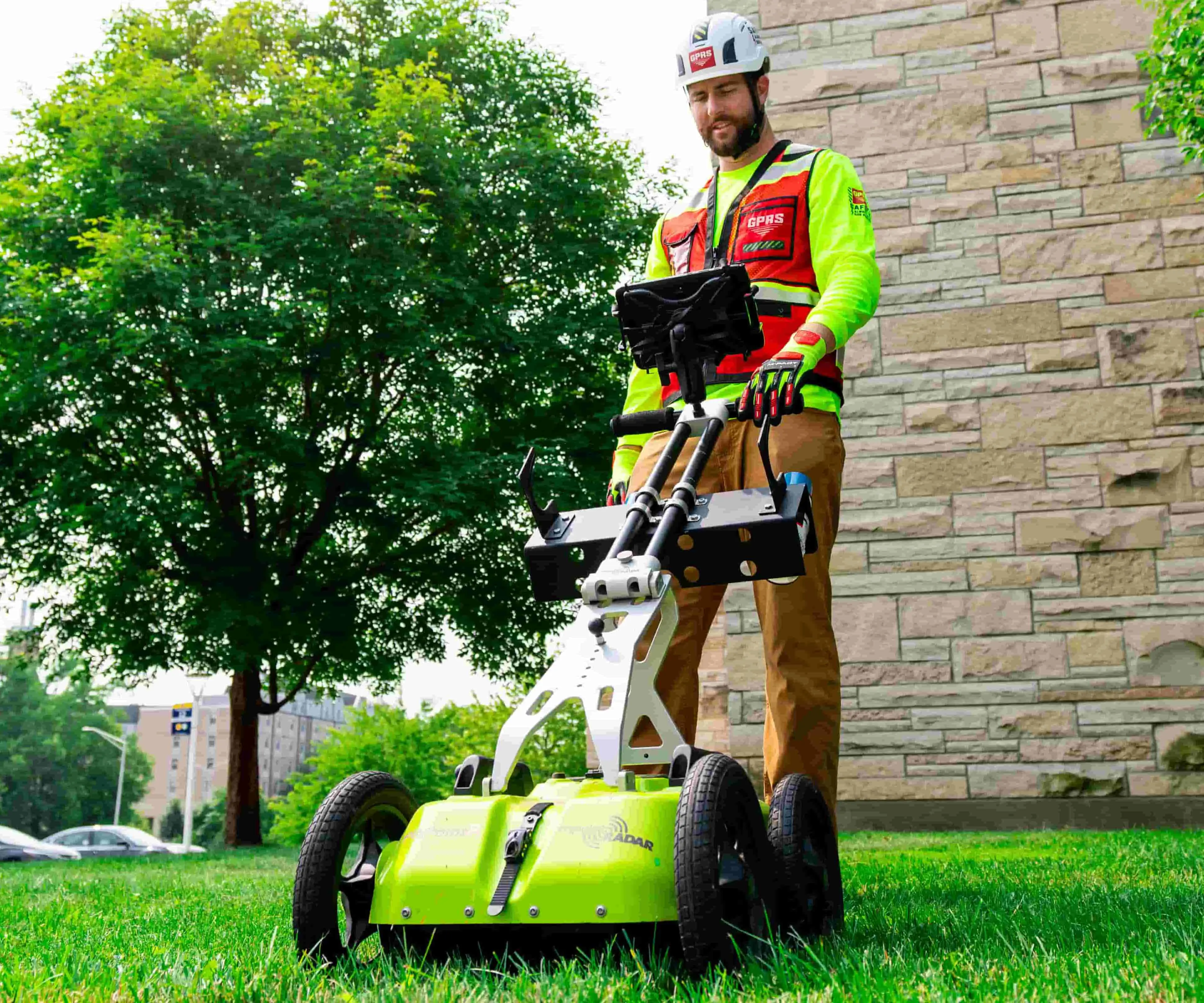
At GPRS, our SIM-certified Project Managers have achieved and maintain an industry-leading 99.8%+ accuracy rate for precision concrete scanning & imaging, and utility locating.
SIM, or the Subsurface Investigation Methodology, is at the core of our training program that allows our Project Managers to reach this unmatched level of accuracy. To achieve SIM certification – a requirement to work in the field for GPRS – our Project Managers must complete a minimum of 320 hours of field training and 80 hours of classroom training. Through this regimen, they encounter real-world scenarios that prepare them for even the most unique concrete scanning, utility locating, and video pipe inspection scenarios that they may encounter.
This far exceeds the national standard for certification (ASNT SNT-TC-1A) of a minimum of 8 hours of classroom training and 60 hours of practical application coaching for NDT Level 1.
GPRS utilizes two primary technologies when performing a utility locate: ground penetrating radar (GPR) and electromagnetic (EM) locating.
A GPR scanner emits radio waves into the ground or a surface such as concrete, and those waves interact with any subsurface objects they encounter to create a reading of hyperbolas. A GPRS Project Manager is trained to determine, based on the size and shape of those hyperbolas, what type of object was detected and its precise location.
EM locating is a complementary technology to GPR. A transmitter emits a selected frequency through a known utility line, and the receiver detects the signal to determine the precise direction that utility runs underground.
Using these technologies in concert, GPRS Project Managers fully visualize the built world beneath your feet.
Industry-Leading Utility Mapping
All that data we collect for you – including any video pipe inspection, leak detection, 3D laser scanning, and mapping & modeling data – is then instantly uploaded into SiteMap® (patent pending), our industry-leading, cloud-based facility management platform.
SiteMap® represents a new era for comprehensive infrastructure visualization, encapsulating what the CGA notes is necessary to achieve its “aggressive” 50-in-5 challenge, in which they’re calling on stakeholders to reduce damages to critical underground utilities by 50% in five years.
By having the most accurate utility data consolidated in one easy-to-access, yet secure platform, you reduce the opportunities for lost or inaccurate data that lead to costly and potentially dangerous subsurface damage. And because the data is collected in-person by GPRS Project Managers, and not an AI-generated guess based on inaccurate historic documentation, you can rest assured that you’ll be able to Intelligently Visualize The Built World® while keeping your project on time and budget, and your team safe.
What can we help you visualize? Click the links below to schedule a service or request a quote today!
Frequently Asked Questions
Does GPRS offer same day private utility locating?
Yes. In many cases, our Project Managers can respond rapidly to emergency same-day private utility locating service calls on your job site. With over 500 Project Managers strategically stationed across every major market in the U.S., GPRS always offers our industry-leading utility locating services near you.
What are the benefits of underground utility mapping?
Mapping your subsurface infrastructure saves you time and money during construction, repair, and regular maintenance projects. By knowing exactly where every utility is located, you avoid having to waste time on excessive potholing. And of course, accurate subsurface infrastructure information helps mitigate subsurface damage during groundbreaking activities.
What type of information does GPRS provide when performing a utility locate?
Our Project Managers will flag and/or paint our findings directly on the surface, depending on your specific needs.
This method of communication is the most accurate form of marking when excavation is expected to commence within a few days of service. Additionally, GPRS uses a global positioning system (GPS) to collect data points of findings.
Our in-house Mapping & Modeling team uses this data to generate a plan, .KMZ file, satellite overlay, or CAD file to permanently preserve results for future use.
You also receive a SiteMap® Personal subscription with every GPRS Utility Locate.