

.svg)
Discussing your next project before hiring a 3D laser scanning company can bring huge benefits. At GPRS, we have turned our experience into the information you need to make your project successful.
Here are seven topics to discuss with your laser scanning service provider before you get a quote:
1. Discuss the intended use of the laser scan data
The first step prior to 3D laser scanning is to discuss how you plan to use the data.
- Will it assist in design engineering?
- Verify existing conditions?
- Coordinate mechanical trades during the construction phase?
- Retrofit plant upgrades?
- Prefabricate building components?
With this information, we can advise you on the best scanning method and 3D laser scanning equipment for the project. All project stakeholders, such as architects, engineers, contractors, etc. should be involved at the beginning to define the project requirements.
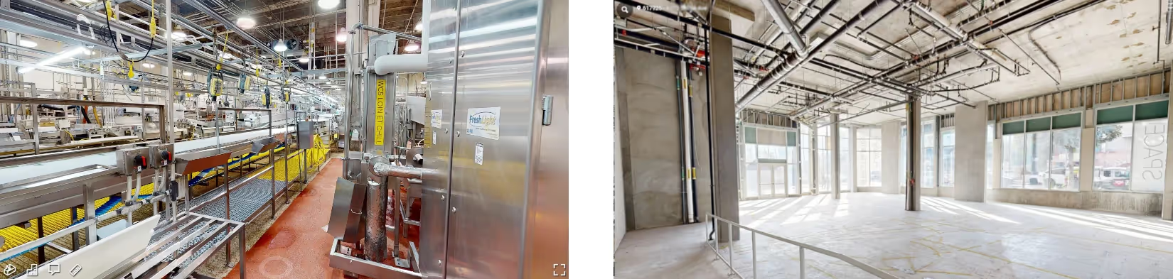
2. Communicate the environment for laser scanning
Be sure to communicate details of the physical space that requires scanning.
- Is it interior or exterior space?
- Occupied or unoccupied?
- Is it finished or demolished space?
- Are any areas that are heavily congested or difficult to access?
Providing GPRS this information will prepare the best scanning methodology while on site and ensure we have the appropriate equipment and number of Project Managers.
3. Define the scope of work
Be sure to provide a clear description of the project scope. What exact details of the project space do you want to capture? This will ensure we collect all necessary project information while onsite the first time. It will be time consuming and expensive to go back and collect missing information. Adding or changing scope onsite can be problematic if appropriate pre-planning is not performed. The necessary tools and equipment may not be available if the scope changes, potentially causing change orders and delays.
4. Discuss the CAD and models needed
Discuss the drawings and models you think you’ll need.
- Do you just want the point cloud?
- Do you want 2D drawings or a 3D model?
- Are you going to use it in AutoCAD or Revit, or another software?
- Do you want an intelligent 3D BIM model or would a generic solids model suffice?
- Do you need 2D floor plans, elevations, or reflected ceiling plans?
Be sure to state the specific software, version, and file format that you will need. Also, be sure to communicate how you would like the data delivered. Would you like it uploaded to a file sharing platform or shipped on a hard drive? Keep in mind that data sizes can be in the hundreds of gigabytes into the terabytes, so many users prefer having a drive shipped to them in lieu of trying to download and store such large files on their local machine.
5. Define the BIM modeling LOD (Level of Detail)
Know what space you want modeled and how detailed you want the modeling to be for each feature.
- Do you need all piping detailed, or pipes above a certain diameter?
- Do you need just walls, ceiling and floor, or do you need doors, windows, furniture, light fixtures, or other features?
- How much detail do you need 3D modeled for each item?
- Is a generic window good enough for the project needs or do you need the exact window details?
By defining LOD specifications for each area scanned, we can clearly communicate with each other without confusion for faster execution. Keep in mind that the greater detail and more features needed, especially finite details, will take longer and cost more to create the final 3D BIM model.
6. Communicate the project timeline
What is the timeline to deliver the finished product? The data from laser scanning will be of little use if it’s not available at the crucial deadline. Do you want the point cloud data (raw data) immediately to view and reference? It takes the GPRS Mapping & Modeling Team additional time to create 2D CAD drawings and 3D models from the point cloud data. Also, if you have a short timeline, is it possible to prioritize which features are modeled first and provide progress models along the way to allow the project to keep moving forward while the deliverables are completed to the needed specification.
7. Communicate site access and requirements
Communicate the best time to access the site and any requirements prior to entering the site.
- Are you looking to scan a site that is restricted, like a processing plant, or one that can only be scanned at night, like an airport terminal?
- Is there any safety training, such as OSHA 10, OSHA 30, Fall Protection, or Confined Space?
- Are there access requirements, such as security clearance requirements, background checks, or does the site require a badged escort?
GPRS will develop a site access plan with you to efficiently complete laser scanning. We want to make sure we can access the site the day of scanning, and anyone that needs to know that the Project Managers will be on-site is notified ahead of their arrival. The faster and more efficiently the Project Managers can get on and off site will reduce costs and avoid overages and change orders for extended trips or remobilizations.

Why GPRS? The GPRS Difference.
Each member of GPRS’ elite team of over 500 Project Managers has completed the industry-leading Subsurface Investigation Methodology (SIM) program. This program defines protocols for 3D laser scanning that far exceed the industry norm.
The SIM program consists of 80 hours of hands-on classroom training and 320 hours of mentorship in the field, plus another 40 hours of LiDAR training to ensure Project Managers’ competence in 3D laser scanning equipment and field knowledge.
GPRS is the nation’s leading provider of utility locating, concrete scanning and imaging, 3D laser scanning, video pipe inspection, leak detection, drone photogrammetry, and mapping & modeling services for the construction, architecture, and engineering industries. Since 2001, GPRS has led the industry, providing accurate data and outstanding service to improve planning and communication and mitigate risk for your team.
What can we help you visualize?
Frequently Asked Questions
Can you scan large areas or multiple levels of a building?
Yes, it is possible to scan large areas and even multiple levels provided there is a way to traverse around the site, doing scans in locations with common lines of site. To be able to go up levels inside buildings, it is necessary to have at least one stairwell to traverse between levels. It is often preferred to have at least 2 stairways, one on either side of the building ideally, or a line of site to a common point though an open door or window from each level.
How do I know if I need 3D laser scanning services for my project?
If you’re considering laser scanning and need help answering these questions or determining if laser scanning is right for you, call us at 419-843-7226 or email Laser@gprsinc.com. Tell us as much as you can about your project and what you think you may need from us, and we’ll talk with you about your options.