On April 22, 2024, CoStar Group, Inc. announced its plans to purchase construction tech company Matterport for an estimated $1.6 billion in “enterprise value,” according to its press release.
As one of the self-described “first adopters” of Matterport’s technology, CoStar references the wide swath of data the 3D capture technology company has amassed; “Over 12 million spaces captured in over 177 countries, and representing more than 38 billion square feet of digital property.”
It appears that another substantial reason for CoStar’s acquisition is the artificial intelligence software, Cortex, that Matterport is touting as an AI engine for digital twin generation, virtual tours, and measurements. Matterport recently added a suite of “Property Intelligence” AI features and plug-ins to aid AEC contractors working in large spaces.
However, there seems to be some question as to the accuracy rate of the AI-generated images, specifically those 2D images taken with cameras other than Matterport. An article from Geo Week News quotes Matterport business development manager Tomer Poran as saying that the AI accuracy rate for those kinds of images have up to an 8% error rate.
Matterport maintains that its accuracy rate when using their own technology is still 1% or less.
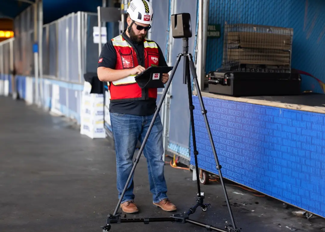
GPRS utilizes Matterport technology as part of our reality capture services, and our WalkThru 3D, FLRPLN, and ProCap products. It has tremendous value in its ability to capture our 99.8% accurate field markings to allow our Mapping & Modeling Team to create integrated digital twins that incorporate above and below-ground infrastructure to provide a 360-view of any site or facility.
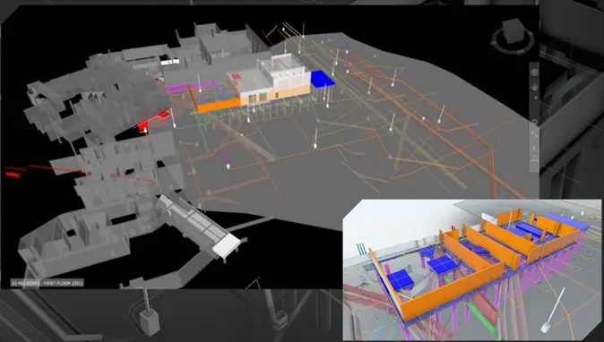
These integrated 3D BIM models and 2D CAD drawings can even incorporate proposed design and renovation plans to avoid or eliminate clashes, utility strikes, or strikes to concrete reinforcements before they happen.
All GPRS drawings, maps, and models are delivered via our proprietary infrastructure data, facility and project management software, SiteMap® (patent pending). Every GPRS customer receives a complimentary SiteMap® Personal subscription as part of our service.
For a greater level of detail (LoD) for your existing conditions, GPRS provides complete 3D laser scanning (LiDAR) services with 2-4mm accuracy.
More on Matterport’s Sale
CoStar Group, the multinational corporation dedicated to “digitizing the world’s real state,” was founded in 1987 and has been on a buying spree the last few years, having previously acquired OnTheMarket, Houses.com, Homes.com, Off Campus Partners, Move, Fairmas, and RealBase, among others.
The specifics of the Matterport acquisition include a $5.50 per share purchase price. Matterport shareholders will receive a $2.75 cash pay-out and $2.75 in CoStar shares for every Matterport stock currently held.
The $1.6 billion valuation may seem generous. However, the Costar purchase price reflects a steep downward valuation from the $9.8 billion market cap (a 480% annual valuation and 88.5 times its 2021 revenue) it boasted after its initial public offering (IPO) in 2022.
Some construction and infrastructure watchers cite Matterport’s decision to shift into a recurring revenue/subscription model as the cause of its slide. But its vast trove of aggregated data, and expanding pipeline to grow it, may be exactly what enticed CoStar to purchase them – to bolster their own data network while also wiping out potential competition.
Or, perhaps it is as Andy Florance, CoStar Group CEO put it in the press release announcing the acquisition, “People now select their next home, apartment, office, store, hotel or warehouse on their mobile devices, often without ever visiting the property. There is no better way to remotely experience space than via Matterport.”
Frequently Asked Questions
How does Matterport work?
Matterport cameras provide 3D photogrammetry, which means they allow you to capture a 360-degree, 3D view of your space via individual images that can be carefully stitched together, AKA rectified, to provide accurate spatial and geographical documentation. Read more about 3D photogrammetry, here.
How do I get a 3D walkthrough or BIM model of my site or facility?
GPRS offers full site visualization via our 3D photogrammetry and 3D laser scanning services. A Project Manager can usually scan a site or facility in a matter of hours or days, although large sites may require weeks to fully capture.
If we have provided utility locating or concrete scanning at the site, 3D photogrammetry can capture those field markings and allow our in-house Mapping & Modeling Team to assemble an accurate Walkthru 3D virtual tour. If 3D laser scanning is also employed on site, GPRS can create a fully integrated above and below-ground BIM model that is accurate to 6mm for existing condition documentation, planning, and design purposes. Learn more about 3D scanning here.