America’s infrastructure is receiving some much-needed TLC, in large part due to the influx of funding courtesy of the Bipartisan Infrastructure Act.
As construction cranes dot the skyline and bulldozers break ground on transformative projects, the importance of accurate infrastructure mapping cannot be overstated. In a world where time, budget, and safety are paramount concerns, precise mapping powered by Geographic Information Systems (GIS) technology, utility locating, ground-penetrating radar (GPR), and electromagnetic locating emerges as the linchpin for keeping these endeavors on track.
The Bipartisan Infrastructure Act: A Catalyst for Change
With over $1 trillion allocated to a diverse array of projects spanning transportation, water systems, broadband expansion, and energy infrastructure, this legislation represents a seismic shift in how America approaches infrastructure investment. From repairing crumbling roads and bridges to expanding high-speed internet access in underserved communities, the Bipartisan Infrastructure Act heralds a new era of progress and opportunity for communities across the United States.
The Critical Role of Accurate Infrastructure Mapping
At the heart of any successful infrastructure project lies accurate mapping—a comprehensive understanding of the existing physical and spatial landscape upon which new developments will be built. Infrastructure mapping, facilitated by advanced GIS technology, enables project planners and engineers to visualize, analyze, and manage complex data sets related to land use, topography, utilities, and infrastructure assets. By harnessing the power of GIS, stakeholders can make informed decisions, optimize project designs, and mitigate risks before construction begins.
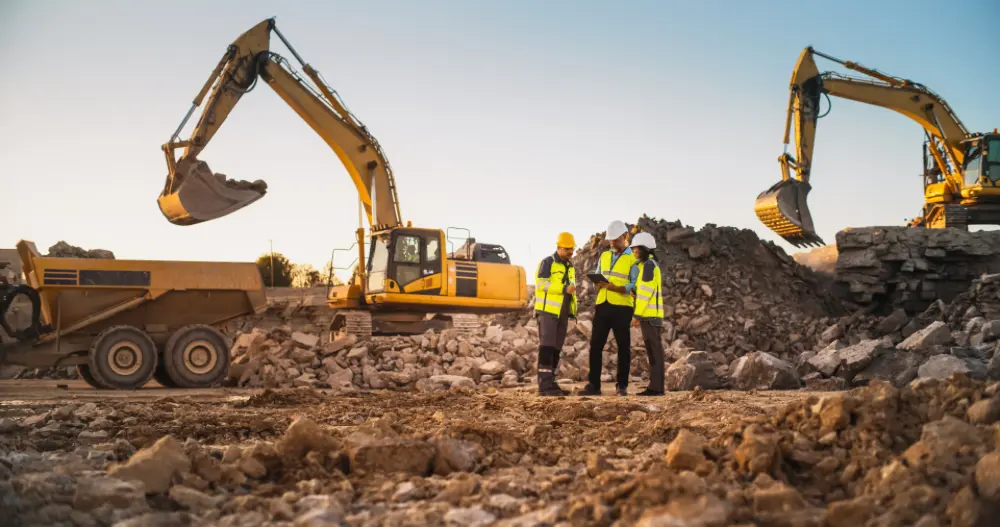
Utility Locating: Unveiling the Hidden Infrastructure
One of the primary challenges in infrastructure development is navigating the labyrinth of underground utilities that crisscross beneath our feet. From water and sewer lines to electrical cables and telecommunications infrastructure, accurately locating buried utilities is essential to avoid costly and potentially dangerous conflicts during construction. GPR and electromagnetic locating techniques offer invaluable tools for non-destructive utility mapping, enabling project teams to identify and map underground assets with precision. By integrating utility locating into the mapping process, project planners can proactively address potential conflicts, minimize disruptions, and ensure the safety of workers and the public.
Enhancing Safety Through Comprehensive Mapping
Safety is paramount on any construction site, and accurate infrastructure mapping plays a pivotal role in safeguarding workers and the surrounding community. By mapping potential hazards such as underground utilities, unstable terrain, and environmental risks, project teams can develop comprehensive safety plans and protocols to mitigate risks and prevent accidents. GIS technology enables real-time monitoring and analysis of safety-related data, empowering project managers to identify emerging risks and implement proactive measures to ensure a safe working environment.
Keeping Projects on Time and on Budget
In the fast-paced world of construction, time is money, and delays can have significant financial implications. Accurate infrastructure mapping enables project teams to optimize project schedules, streamline workflows, and identify potential bottlenecks before they occur. By integrating GIS data with project management tools, stakeholders can track progress, manage resources, and anticipate challenges, keeping projects on track and within budget.

GPRS: Mapping the Path to a Brighter Future
As America embarks on a historic infrastructure renaissance, accurate mapping emerges as the cornerstone of success. From the halls of Congress to construction sites across the country, the Bipartisan Infrastructure Act is paving the way for transformative change.
By harnessing the power of GIS technology, utility locating, and advanced mapping techniques, GPRS allows stakeholders in the construction industry to navigate the complexities of infrastructure development with confidence, ensuring that projects are completed safely, efficiently, and with lasting impact.
From skyscrapers to sewer lines, GPRS Intelligently Visualizes The Built World® to keep your projects on time, on budget, and safe.
What can we help you visualize? Click below to schedule a service or request a quote today!
Frequently Asked Questions
What are the Benefits of Underground Utility Mapping?
Having an updated and accurate map of your subsurface infrastructure reduces accidents, budget overruns, change orders, and project downtime caused by dangerous and costly subsurface damage.
How does SiteMap® assist with Utility Mapping?
SiteMap®, powered by GPRS, is the industry-leading infrastructure management program. It is a single source of truth, housing the 99.8%+ accurate utility locating, concrete scanning, video pipe inspection, leak detection, and 3D laser scanning data our Project Managers collect on your job site. And the best part is you get a complimentary SiteMap® Personal Subscription when GPRS performs a utility locate for you.
Click here to learn more.
Does SiteMap® Work with my Existing GIS Platform?
SiteMap® allows for exporting of data to SHP, GeoJSON, GeoPackage, and DXF directly from any user’s account that either owns or has a job shared to their account. All these file formats can be imported and utilized by other GIS packages if manually imported by the user. More information can be found at SiteMap.com.