Oil & Gas

GPRS is a Trusted Partner to Oil & Gas Companies
Having access to accurate facility information is crucial for project planning. GPRS provides accurate subsurface utility locate and as built infrastructure information to Oil & Gas Companies for project management. We document site data with GPR, EMI, and 3D laser scan technology to deliver up-to-date maps and models for design and operational decisions.
GPRS services national Oil & Gas companies and operations from pipeline to refinery projects, encompassing all phases: upstream, midstream and downstream. We work directly with owners such as Marathon, Cenovus, BP, Husky, Cheniere, Motiva, Chevron, Dominion, Enerfin, Enterprise, DOW, Shell, Air Products, Air Liquide, PBF Energy, and more.
Our elite Project Managers have extensive experience mapping compressor stations, pump/lift stations, terminal facilities, tank farms, storage, pipeline mapping, pipe installation (all midstream activities), as well as, oil well drilling, refineries, distribution, petrochemical plants, and more.
We collaborate with engineering, procurement, supply chain, construction/GC's, and maintenance groups to provide underground utility locating, 3D laser scanning, concrete scanning, video pipe inspection, and void scanning services. Our goal in the Oil & Gas industry is to deliver accurate and reliable underground utility locates and as built site data for private and public Oil & Gas properties. GPRS provides comprehensive maps and models of all assets to ensure our clients have up-to-date records for construction planning and reference.
GPRS underground utility locating, 3D laser scanning, concrete scanning, video pipe inspection, and void scanning services help clients throughout the entire lifecycle of a project, from pre-planning to design and construction, through operations and maintenance. We deliver up-to-date, accurate data to improve communication and coordination, identify hazards to keep all workers safe, reduce errors and reworks, and deliver your project on time and on budget.
With over 400 Project Managers, in every major market and city across the United States, GPRS has an unmatched nationwide service network that makes it quick and easy to find an expert Project Manager in your area. GPRS can reach your location within 24 to 48 hours of contact to solve all and any of your project needs. We can manage data, maps, and models for the entire site. Important operational data can be accessed in real-time to improve operational safety, plan for maintenance, and prevent operational disruption.
GPRS Delivers Complete Infrastructure Visualization
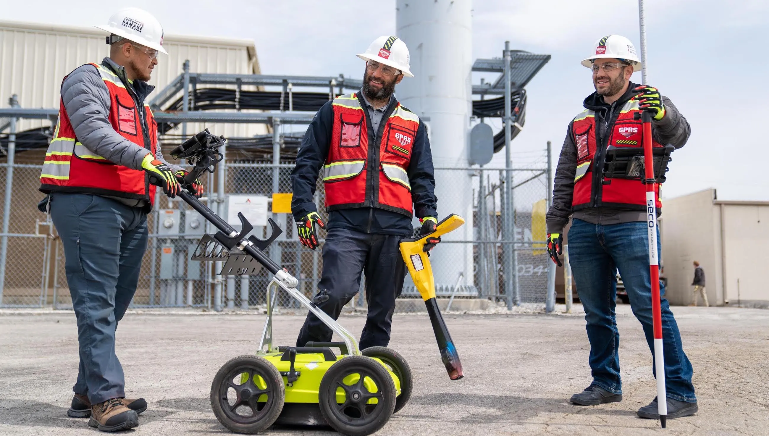
UTILITY LOCATING
Utility locating uses ground penetrating radar (GPR) and electromagnetic (EM) locating technology to detect and map power lines, gas lines, pipelines, water lines, sewer lines, voids, and additional buried utility lines in an area where groundbreaking activities are planned. Utility locating details and maps underground infrastructure to mitigate accidental utility strikes, keeping your people, projects, and facilities safe.
CONCRETE SCANNING
Concrete scanning is a non-destructive method to assess concrete using GPR to locate and identify utilities and objects such as rebar, post tension cables, conduits, and piping embedded within concrete slabs and structures prior to cutting, coring, and drilling. Concrete scanning ensures the safety of workers and prevents accidents by identifying potential hazards before any work occurs.
3D LASER SCANNING
3D laser scanning captures accurate as built data of your site for design planning, facility modifications, plant upgrades, retrofits, prefabrication, and ongoing maintenance. 3D laser scanning provides your team with millimeter-accurate point clouds, 2D CAD drawings, 3D BIM models, and virtual tours for reliable project planning, reducing the risk of change orders and project delays.
VIDEO PIPE INSPECTION
Video pipe inspection deploys robotic crawler CCTV cameras, lateral launch cameras, and push cameras to document and assess water systems, drains, and conduct sewer inspections without costly excavations. NASSCO certified WinCan reports provide the exact location, video, and photo of each defect, ranked by severity so you can plan for maintenance and repairs.
VOID DETECTION
Voids can be detected with GPR to improve safety before placing heavy equipment or cutting and drilling into the subsurface. Settlement and washout from leaking pipes have the potential to cause cracking and slab failure, resulting in accidents and project delays. It is important to detect voids before starting a project to minimize risk to workers on site. GPRS quickly and accurately detects and documents the location, size, and depth of the void in 2D CAD drawings to allow Oil & Gas facilities to complete repairs or revise plans before any problems occur.


Let's Get To Work
Schedule A Project


CUSTOM SERVICE PLANS

Scheduling

Pricing

Approach

mapping & Modeling
GPRS delivers the most up-to-date, accurate and comprehensive site data possible in the format required for your project. We provide complimentary KMZ and PDF maps with every utility locate we perform. Our Mapping & Modeling Team can create a wide variety of customizable maps and models, from a simple GPS-enabled map of your utility locate, to highly-detailed 2D CAD drawings and 3D BIM models, depending on your needs.
AS BUILT DRAWINGS
2D MAPS & 3D MODELS
SITEMAP® MOBILE APP

One Call Program

Public Property
Private Property

Embedment
SAMPLE PROJECTS

Storage tank contour floor plan.

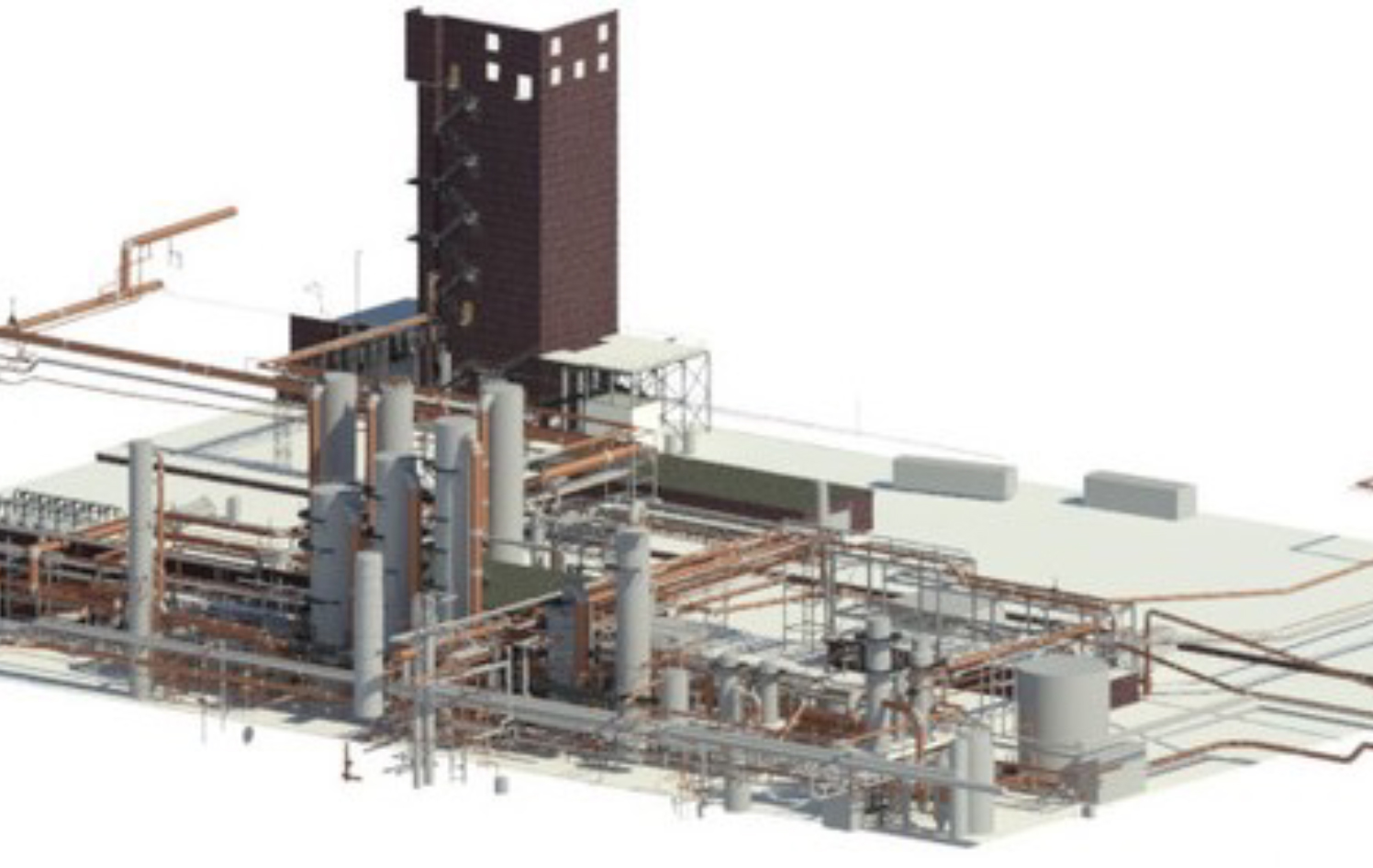
3D BIM model of a coking plant.

3D laser scanning a deepwater oil hub platform.
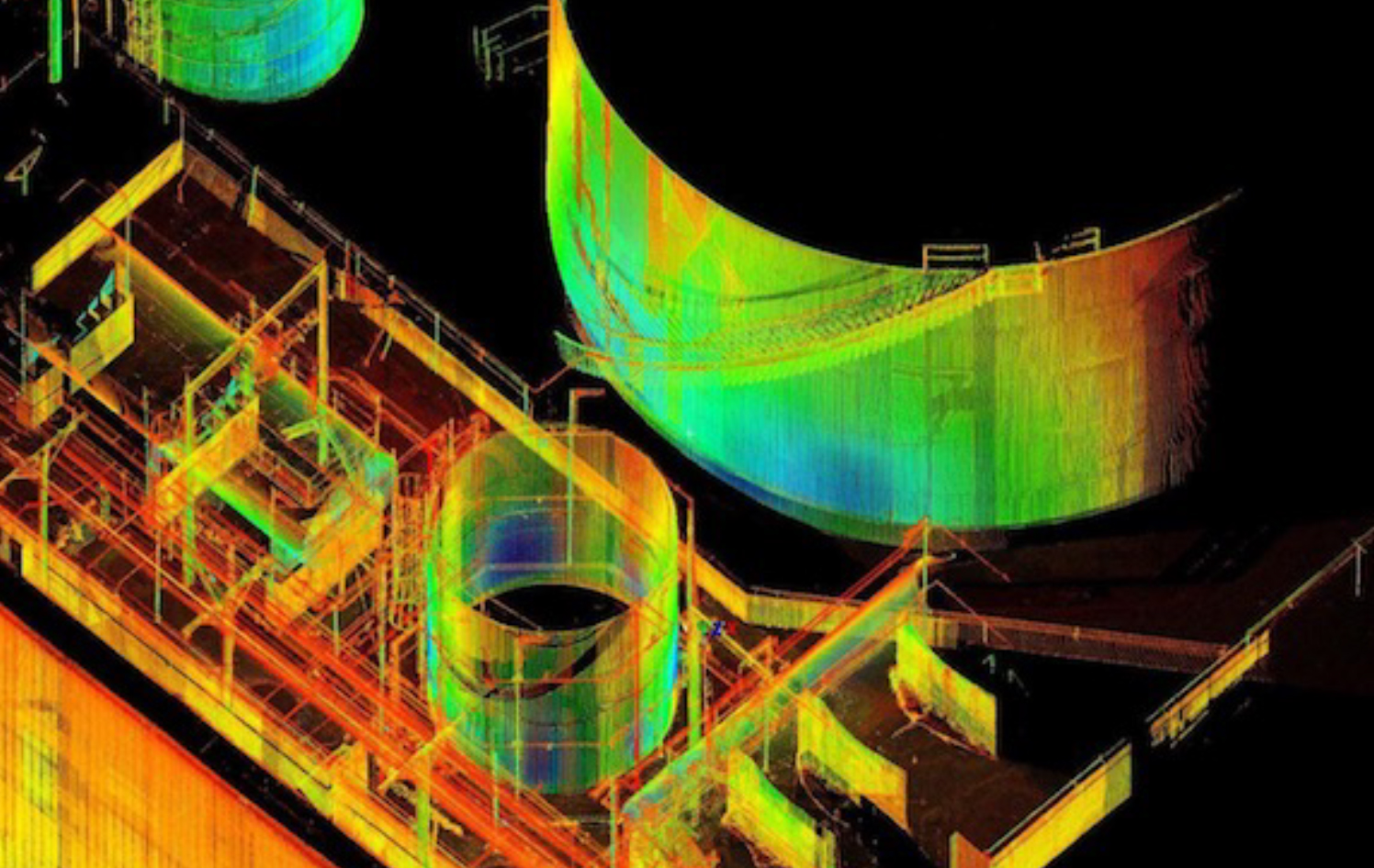
Point cloud data captured for an oil tank replacement.
Revit 3D model to relocate a pipe in the COG line.

3D laser scanning an oil production facility.
FREQUENTLY ASKED QUESTIONS
Will you be able to work with my schedule to avoid disrupting business operations?
Yes! GPRS tailors our services to meet your needs, and that includes working nights and weekends to help limit disruptions to normal business operations. The equipment that GPRS uses is battery operated, emits less radiation than a cell phone, and less noise than a household vacuum cleaner, allowing us to work discreetly.
Can you provide services quickly?
Yes! Our nationwide presence means that a GPRS ProjectManager will be on your jobsite as quickly as 24 hours after initial contact.
Do you have enough manpower to cover multiple stores/sites at one time?
Yes! With over 500 Project Managers strategically stationed across every major market in the U.S., we can respond rapidly to as many sites as needed.
What do I get when you conduct a service for me?
GPRS provides a Job Summary report with basic project information for very project we complete. We also provide complimentary KMZ and PDF maps with every utility locate we perform. And, when we perform a utility locate for you, you receive a complimentary Personal subscription to SiteMap®, our industry-leading, cloud-based infrastructure management platform where you can access, view, and securely share your digitized, layered utility maps 24/7. Beyond that, our Mapping & Modeling Team can create anything from a simple, GPS-enabled locating map of your utility locate, to highly detailed, 2D CAD drawings and 3D BIM models, depending on your needs.
Can you complete your work without my team on site?
Yes, GPRS Project Managers have the capability to complete work with, or without your team present on site, as long as access is granted to the work area. Details of our findings will be communicated to your team immediately upon completion of each project.